|
BEFORE 1991
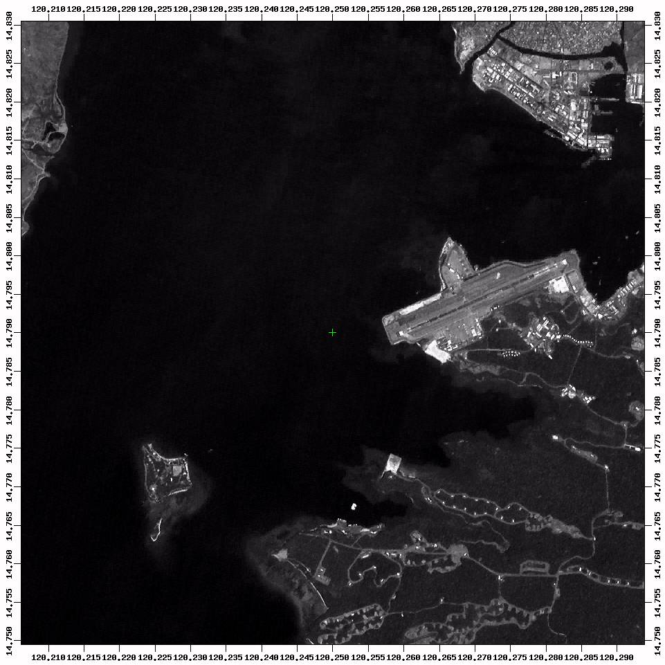
Clark Air Base
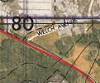 |
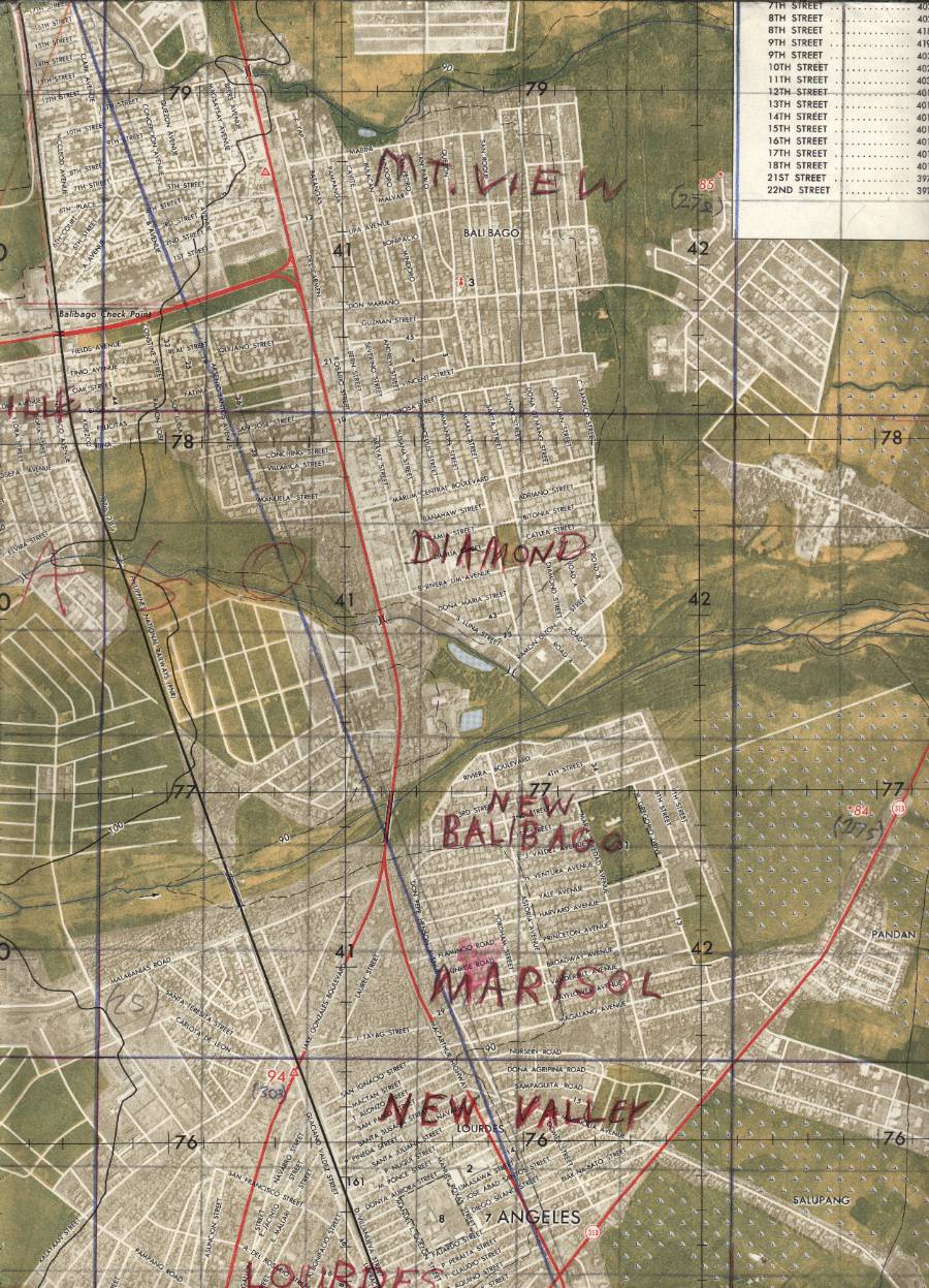
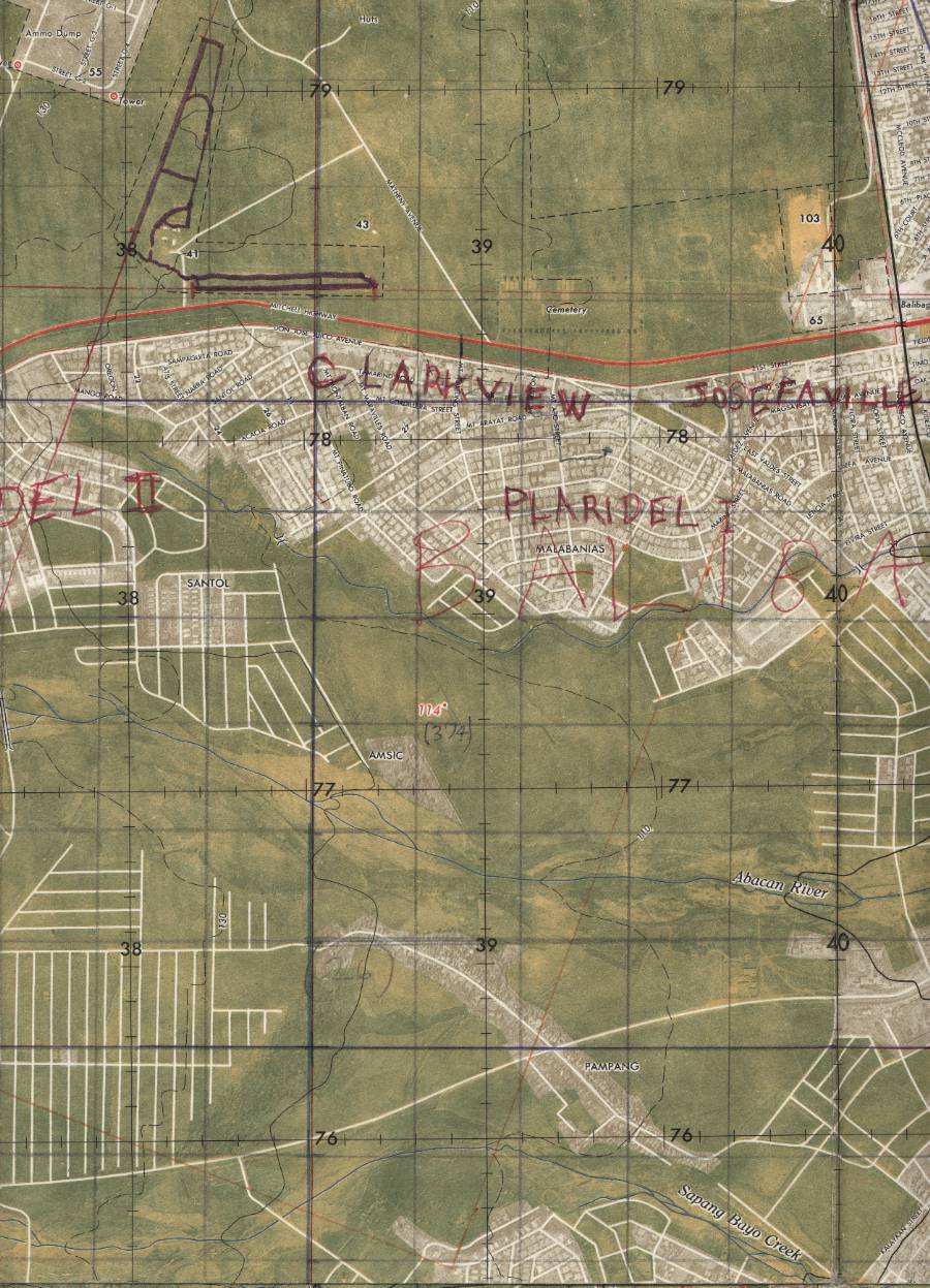
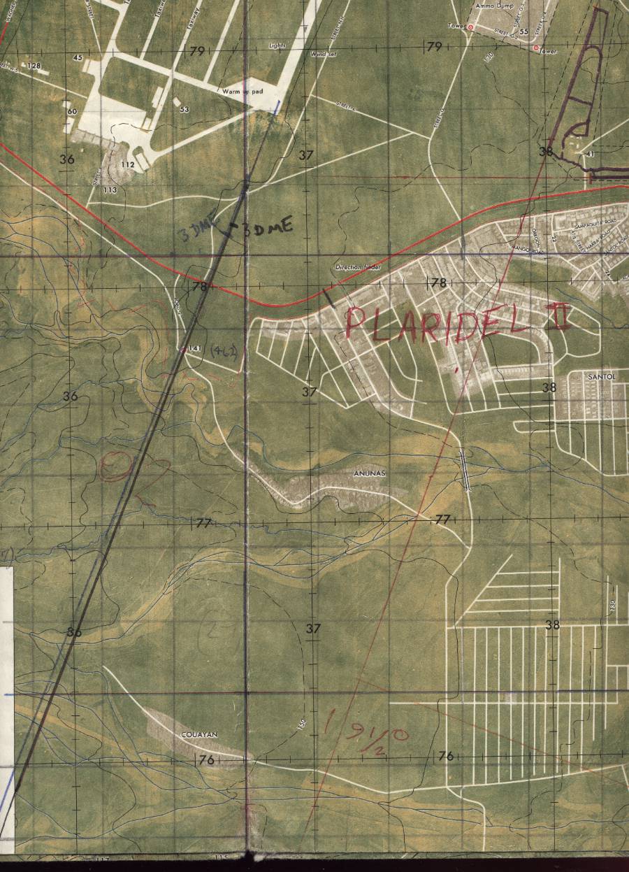
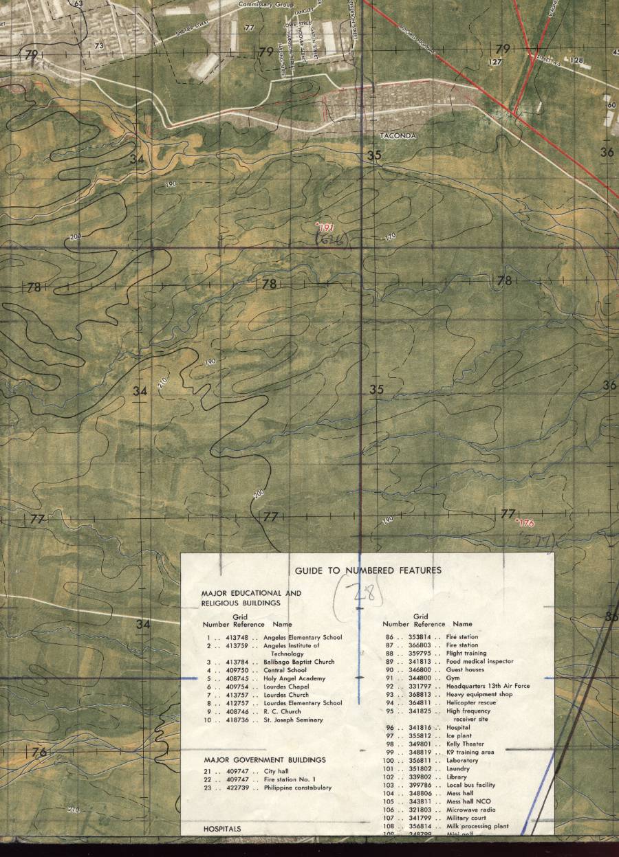
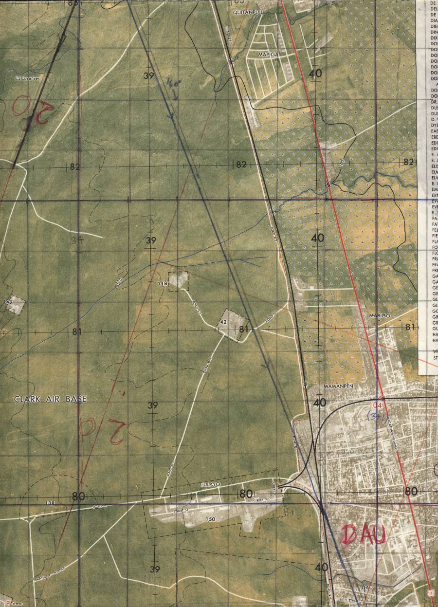
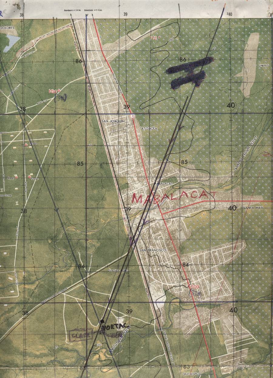
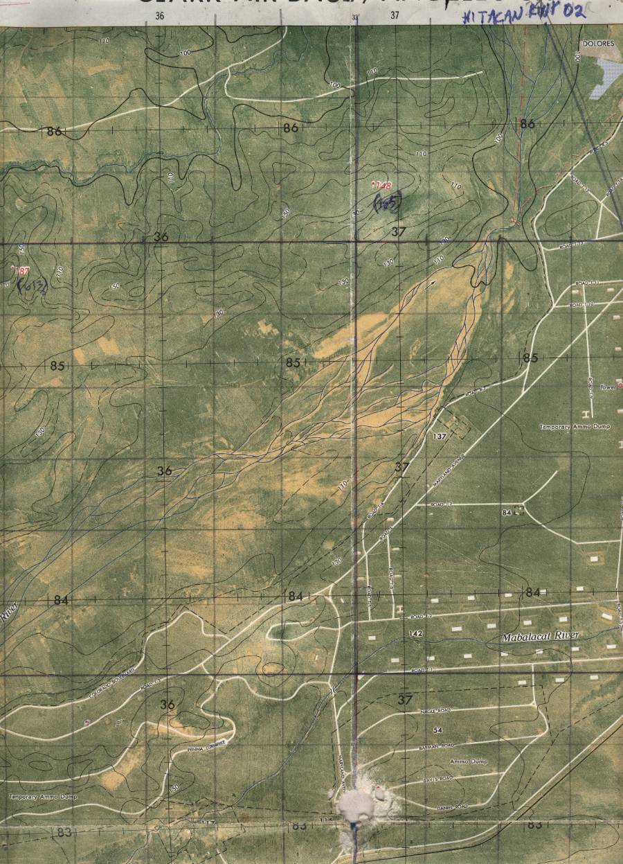
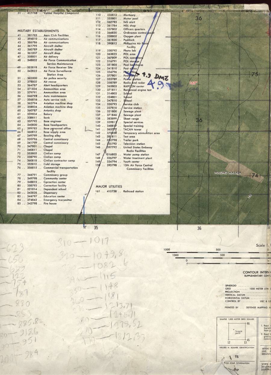
City Picto Map, Clark Air Base / Angeles City.
DMATC S901 Edition 1, March 1974. 1:12,500.
One of the kids in the neighborhood at Clark had this map. Of course
being a map collector even at age 11 I bought it from him for two bucks.
You'll find some markings and notations on this map, mostly from me
from when I lived there.
|
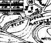 |
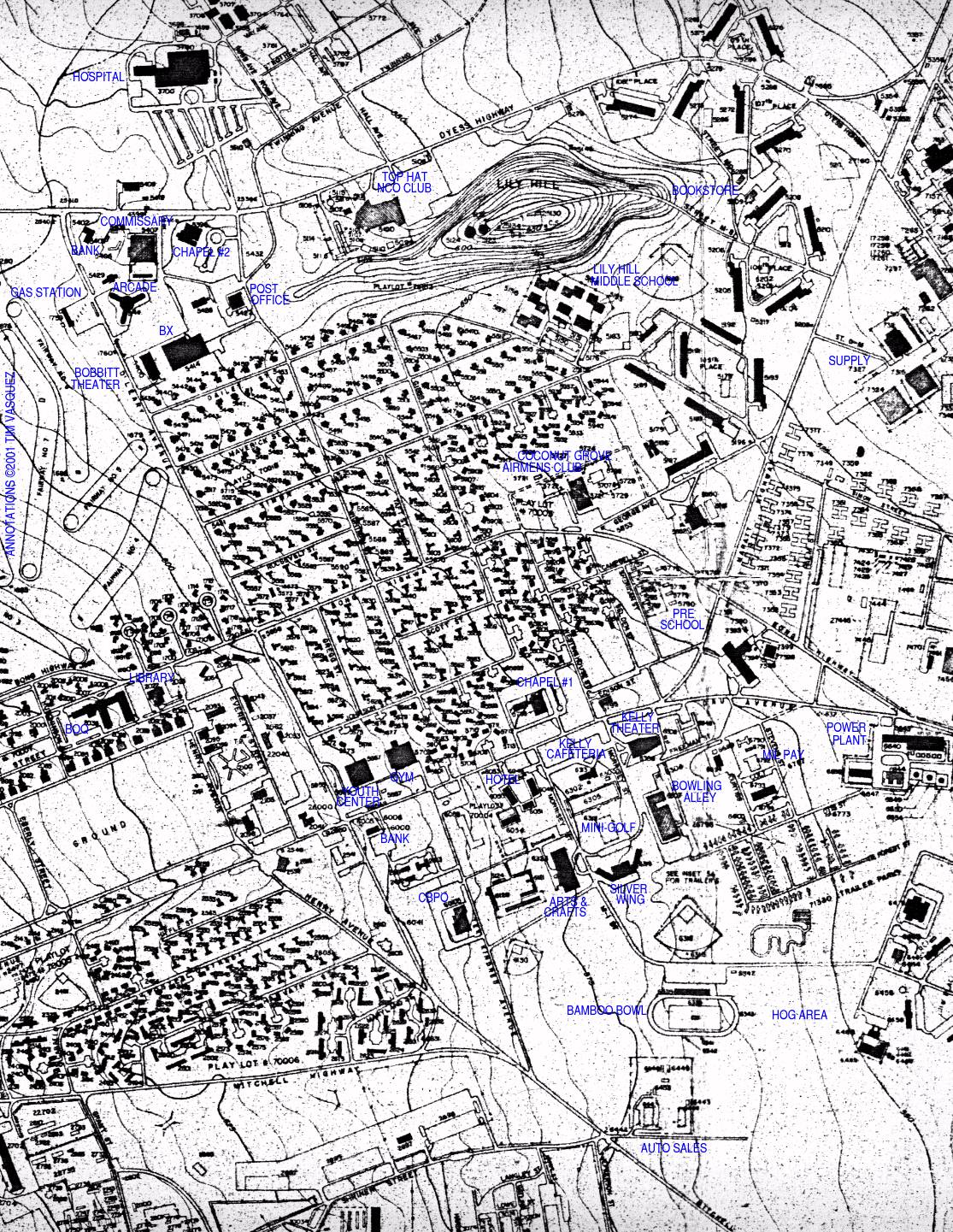
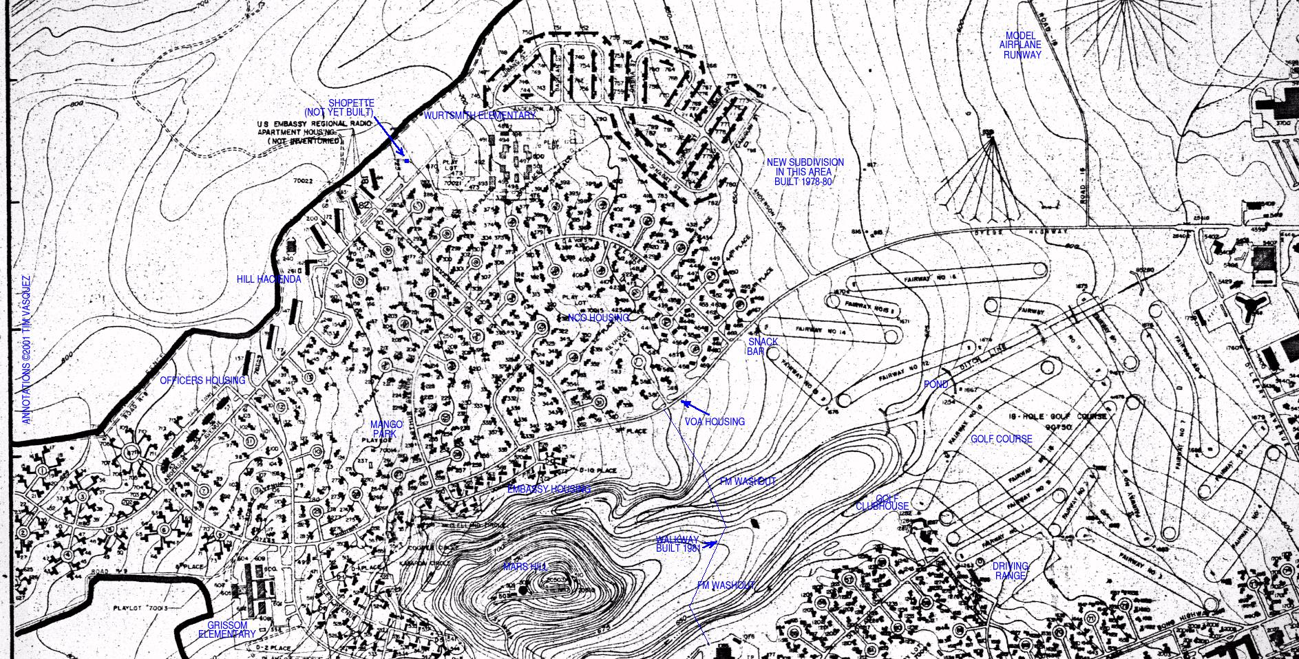
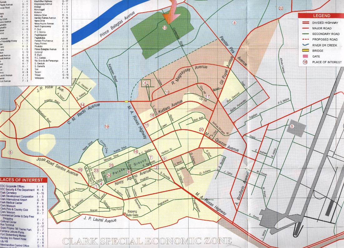
Clark Air Base Blueprints.
Comprehensive Base Plan, Department of the Air Force,
Directorate of Engineering and Services DCS/PRE - Washington DC
1 April 1970 (revised 12 July 1978)
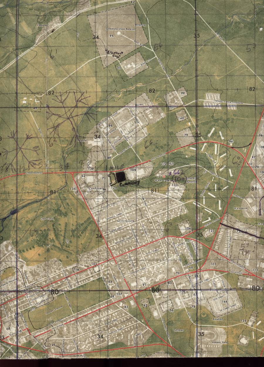
Central Base area -- BX, Commissary,
Top Hat NCO Club, Gas Station, Bobbitt Theater, Library, Golf Course,
Youth Center, Officers Club, 13 AF Headquarters, Chicken Coop, Silver Wing,
Bamboo Bowl, Arts & Crafts Center, Bowling Alley, Coconut Grove Airmens Club,
Lily Hill Middle School, Power Plant.
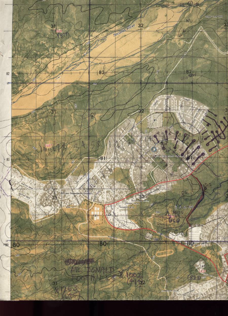
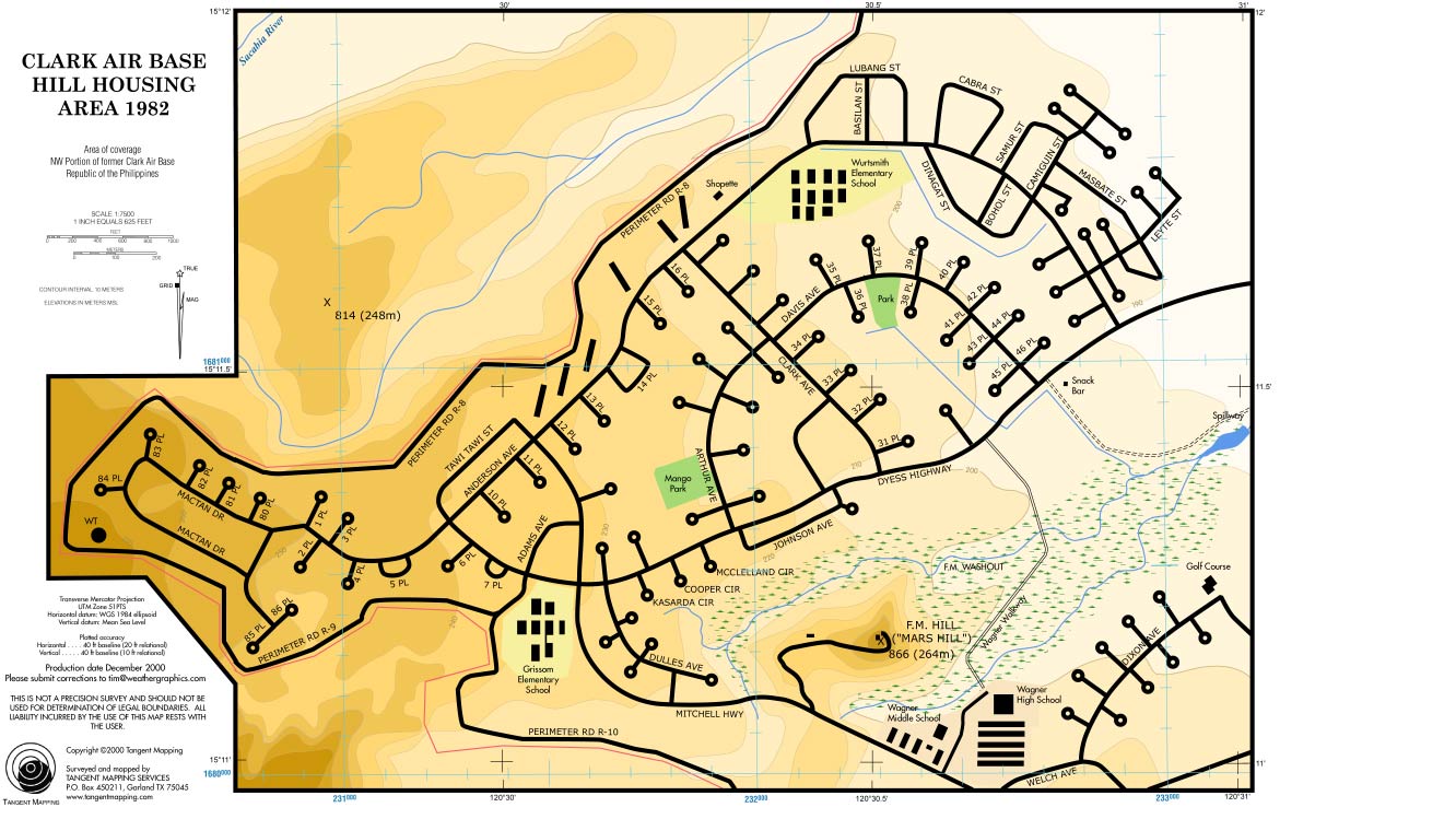
Hill Housing area -- Wurtsmith
Elementary School, Grissom Elementary School, Wagner Middle
School, Wagner High School, MARS Hill, FM Washout, Wagner Walkway
(for Mactan housing area see Southwest Base Area section instead).
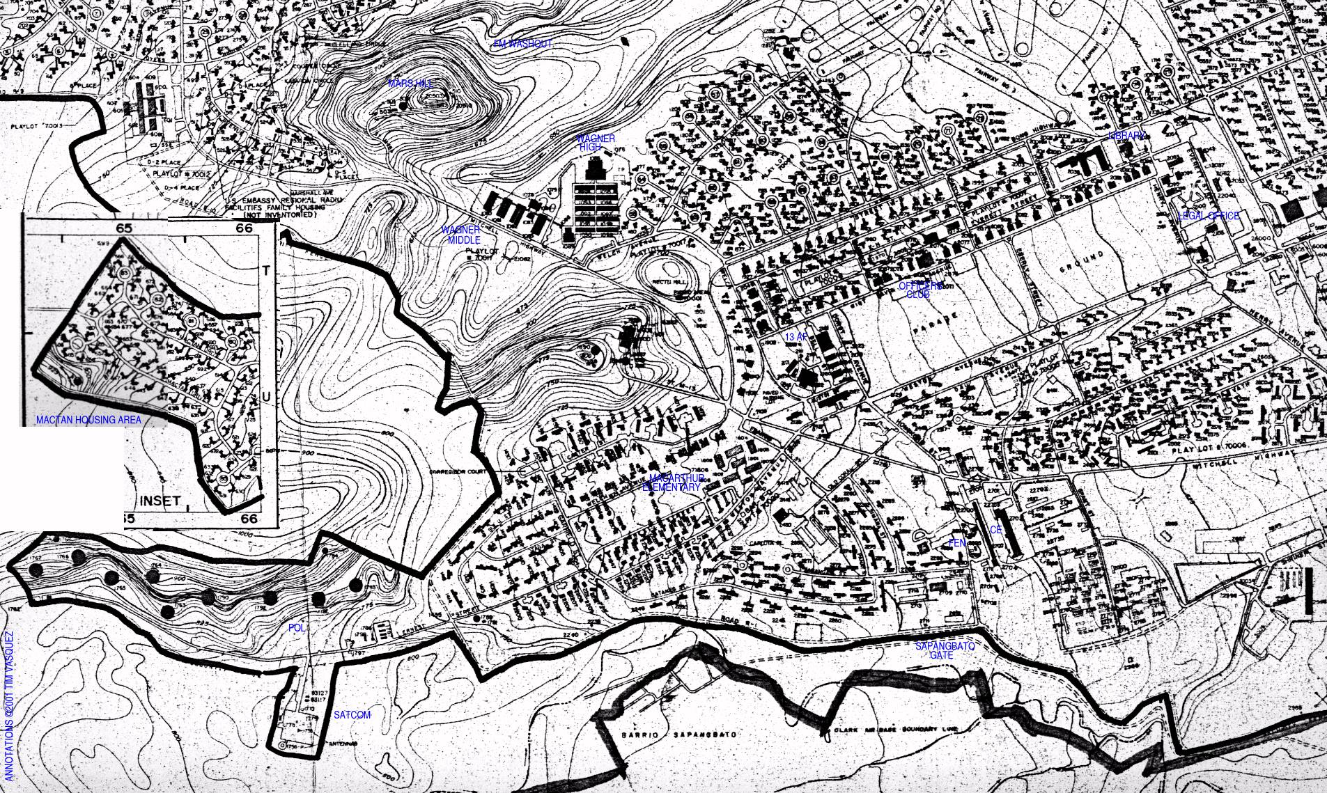
Southwest Base area --
Wagner schools, parade ground, southwest housing areas,
MacArthur Elementary School, CE, FEN, POL, SATCOM,
Mactan housing area inset.
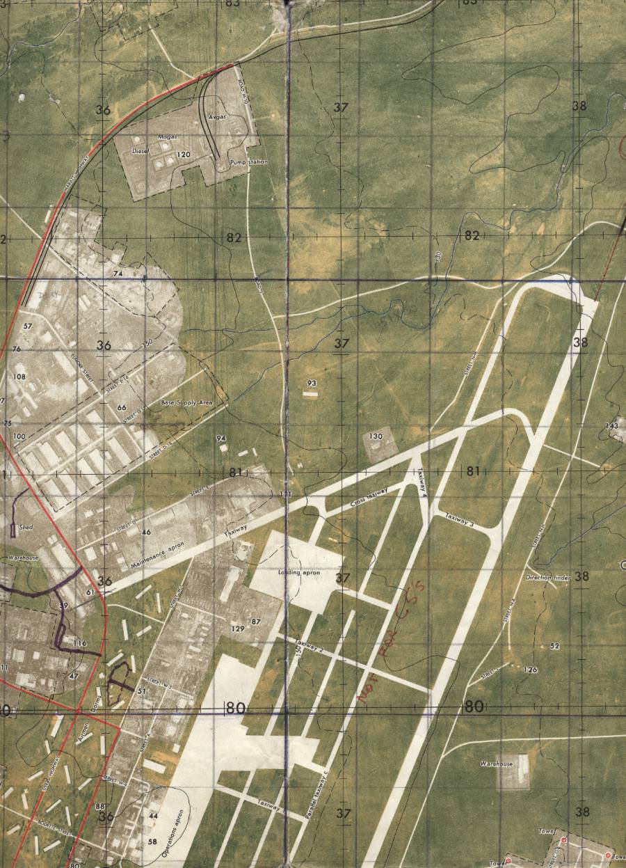
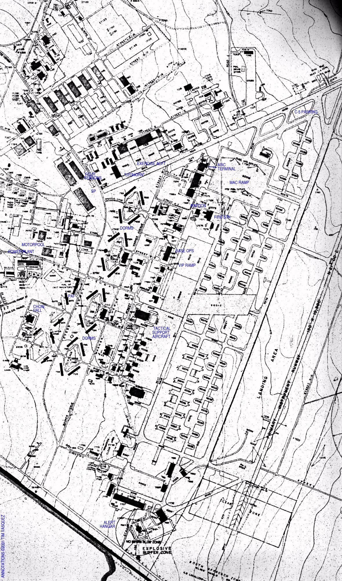
Airfield area -- MAC Terminal,
Base Supply, Power Plant, PAF, Bamboo Bowl, Base Ops, Alert Hangar.
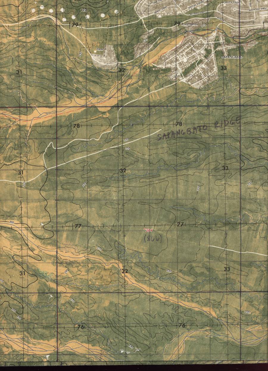
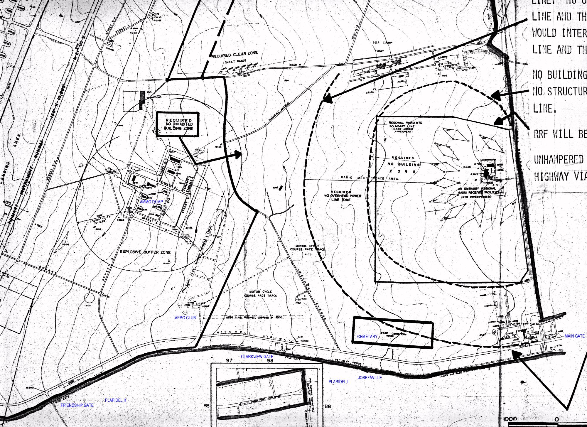
Angeles City area --
does not include Angeles City itself but shows the
on-base areas nearby, including the gates, the Aero Club,
the cemetery, the skeet range, and the ammo dump.
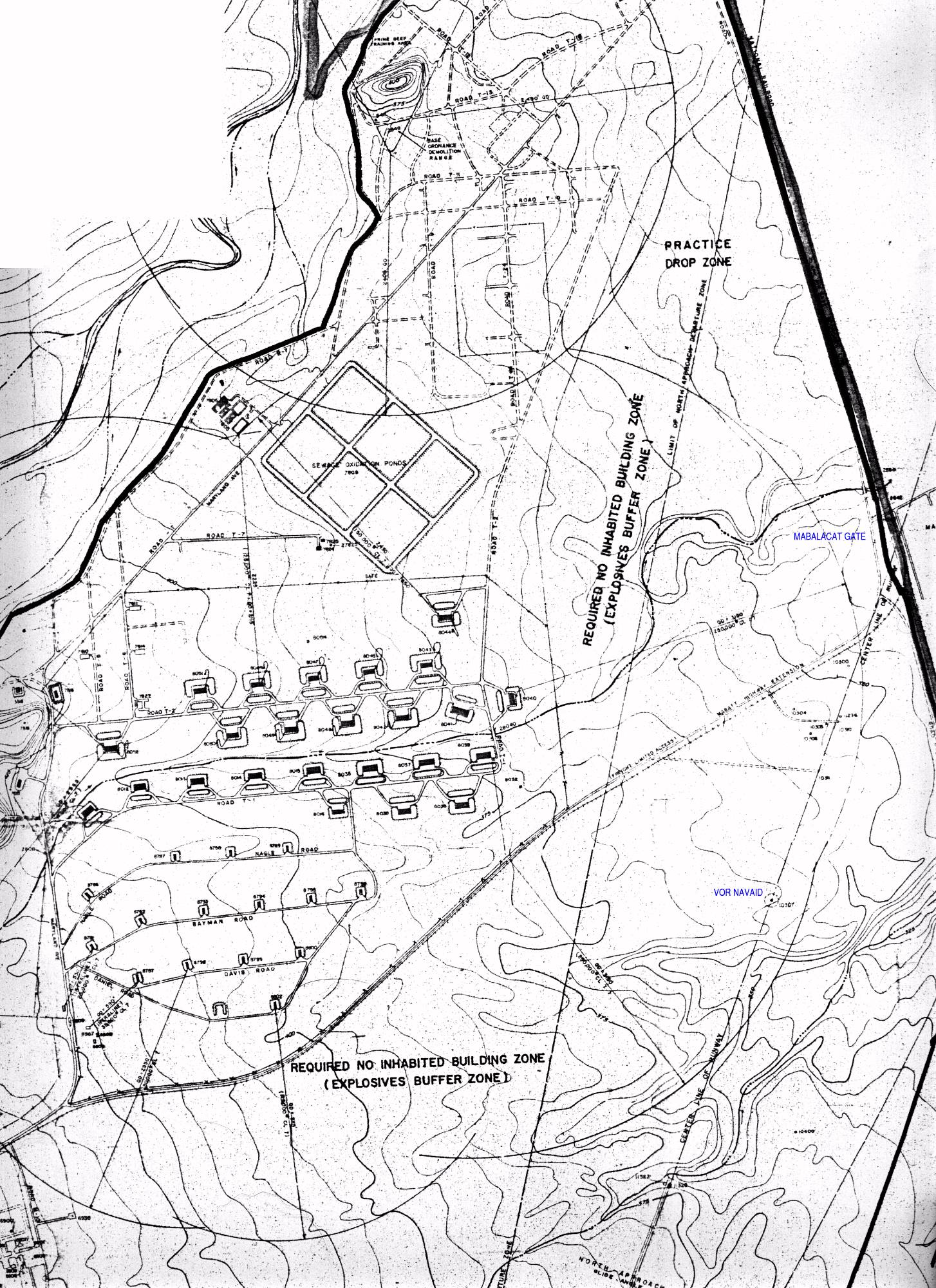
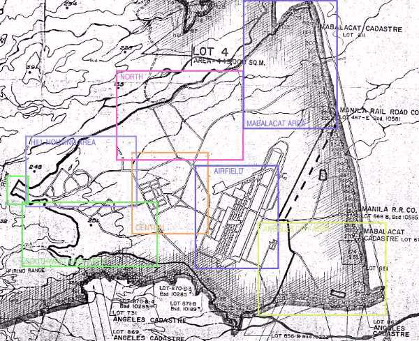
Mabalacat area --
does not include Mabalacat itself but shows the
on-base areas. Includes drop zone, Prime Beef training
area, ordnance demolition range, north ammo dump, and
sewage treatment plant.
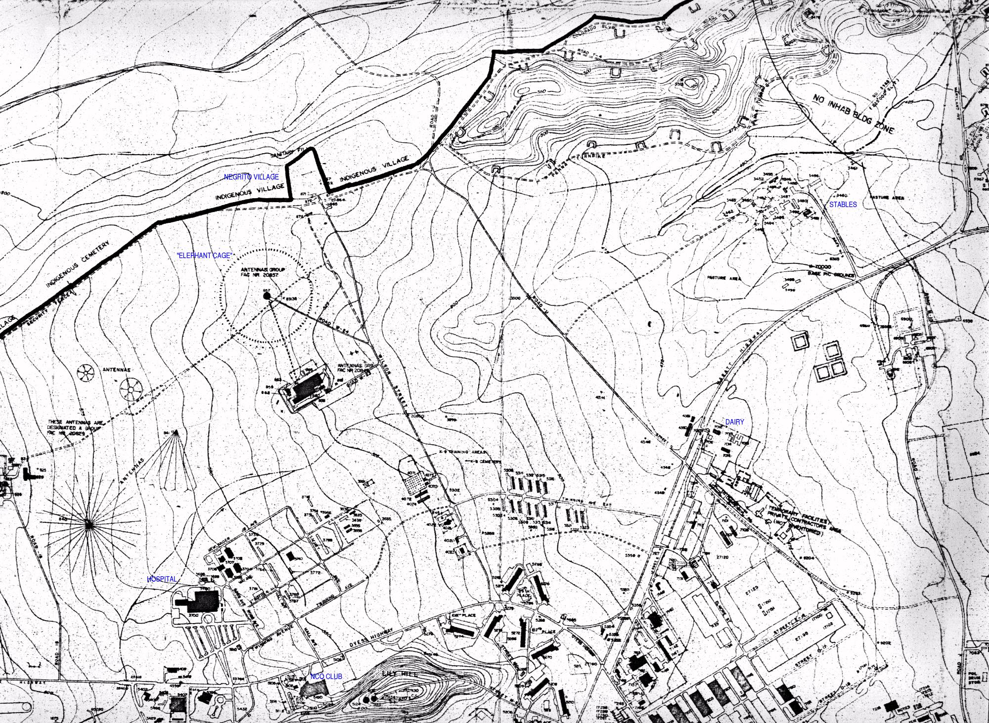
North base area --
"Elephant Cage", stables, etc. There's not really much to see
on this section.
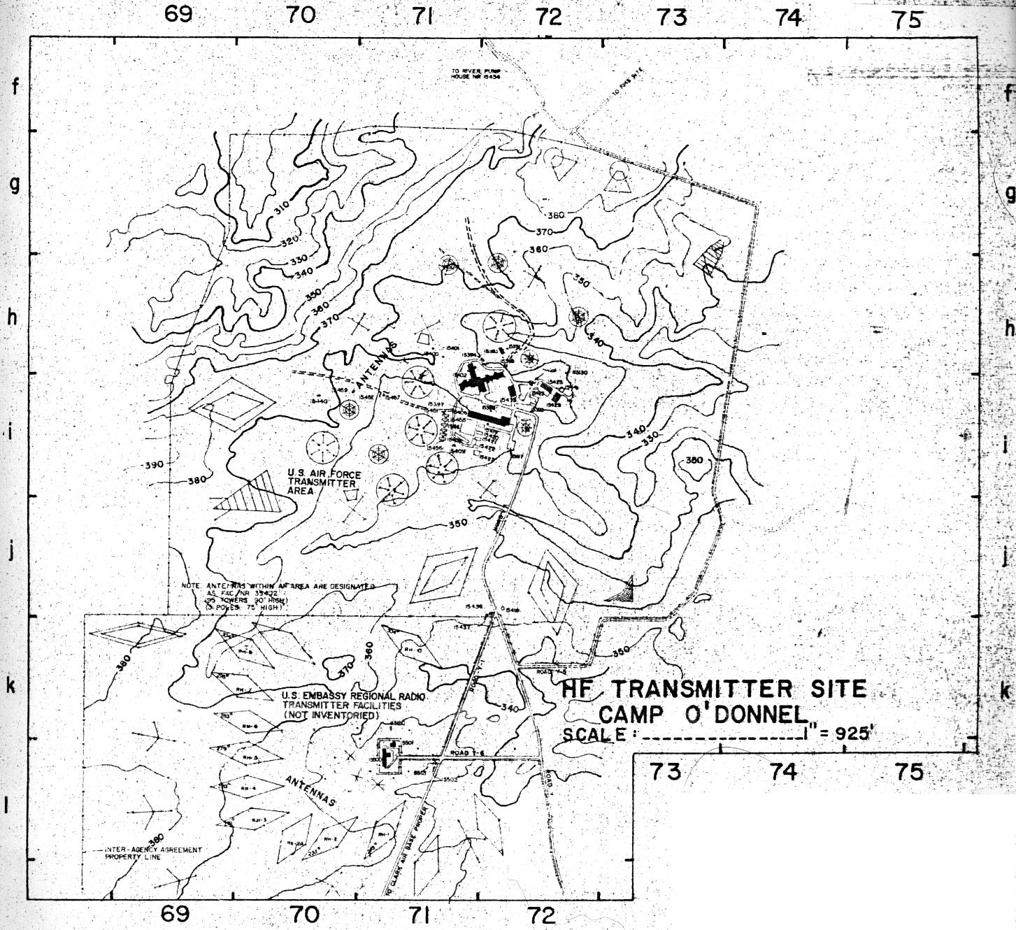
Camp O'Donnell --
small base about 15 miles north of Clark Air Base.
Reference map -- if you're not
sure which section you want to see.
|
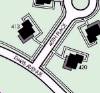 |
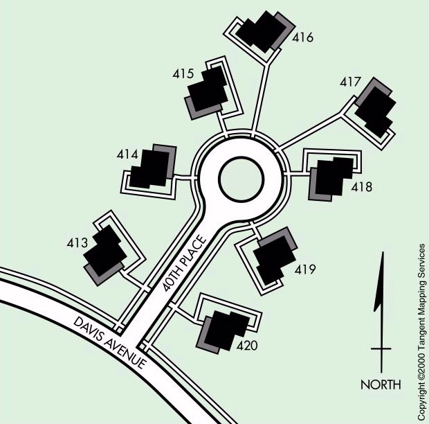
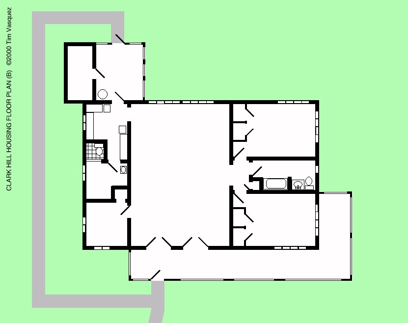
40th Place Layout --
graphic depiction of the layout of a typical circle in the Hill
Housing area.
|
|
AFTER 1991
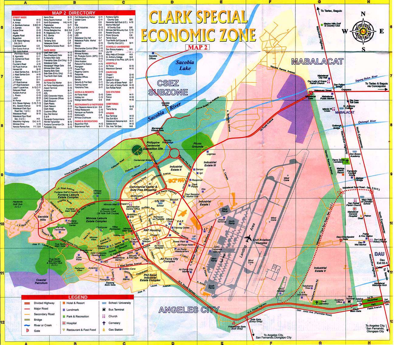
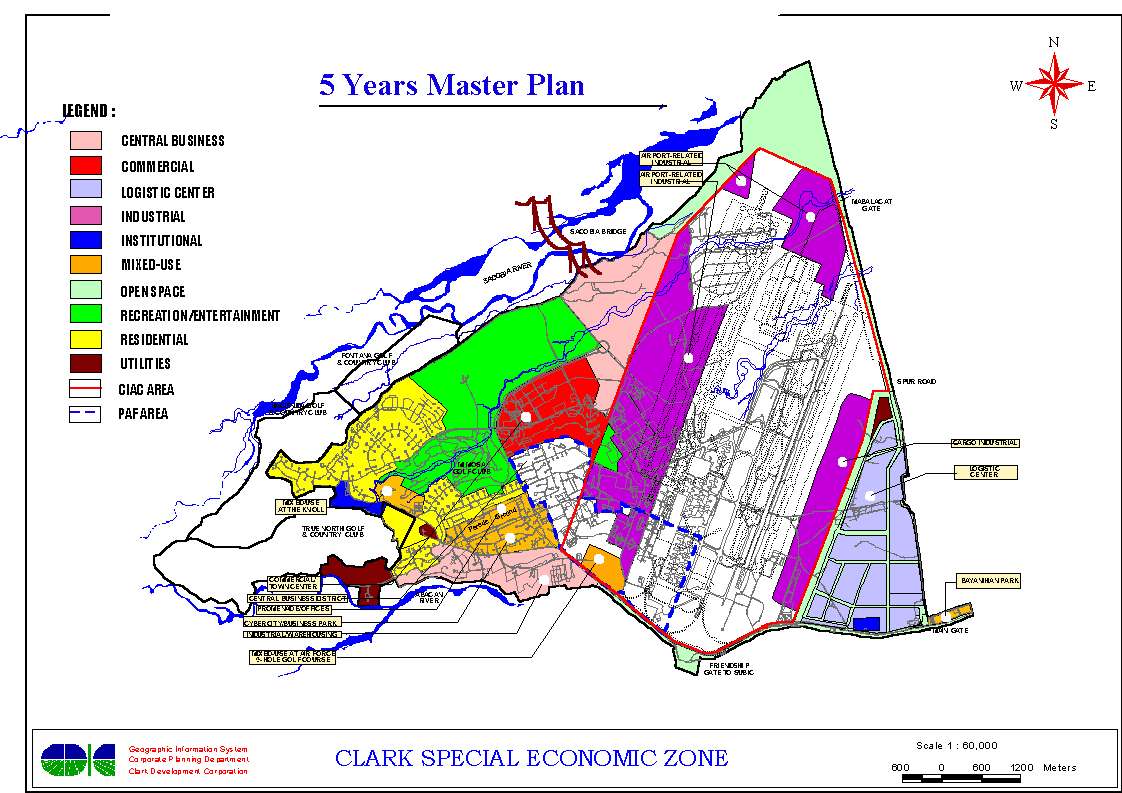
Clark Special Economic Zone
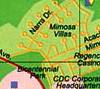 |
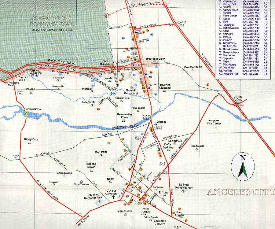
CSEZ Street Map --
this is perhaps the nicest and most thorough map of Clark as
it exists nowadays.
|
|