|
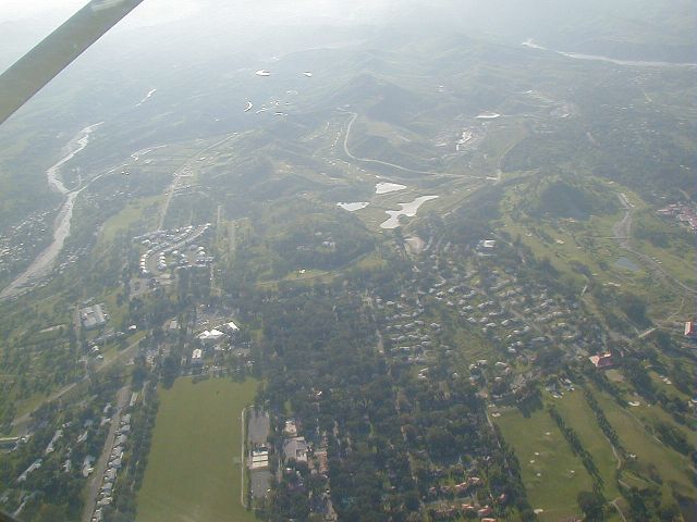
Western Clark AB
This dramatic view of western Clark Air Base was taken at about
5000 ft looking westward. The most prominent feature is the
parade ground in the lower left. The lower left corner was the
old Fort Stotsenberg. The golf course is on the right side of
the photo, and in the distance is Wagner High School next to
a small bumb which is FM Hill (MARS Hill). Note that the FM Wash
surrounding FM Hill has been converted over to a large golf course.
Want to correct or clarify information about this photo?
Send an E-mail to
clarkairbase@clarkab.org.
Mention you are referring to page "a05.htm".
|
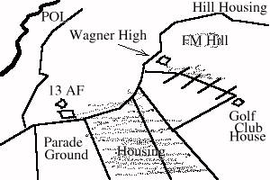
Orientation sketch
|