 |
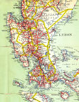
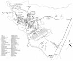
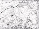
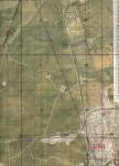
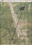
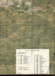
Tactical Pilotage Chart, 1975 (1:500K) shows most of the cities and terrain in central Luzon.
The North Luzon expressway connecting Angeles to Manila had not yet been built.
(Defense Mapping Agency TPC K-10A) |
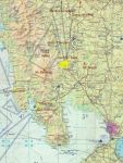 |
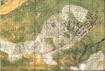
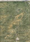
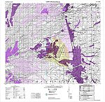
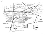
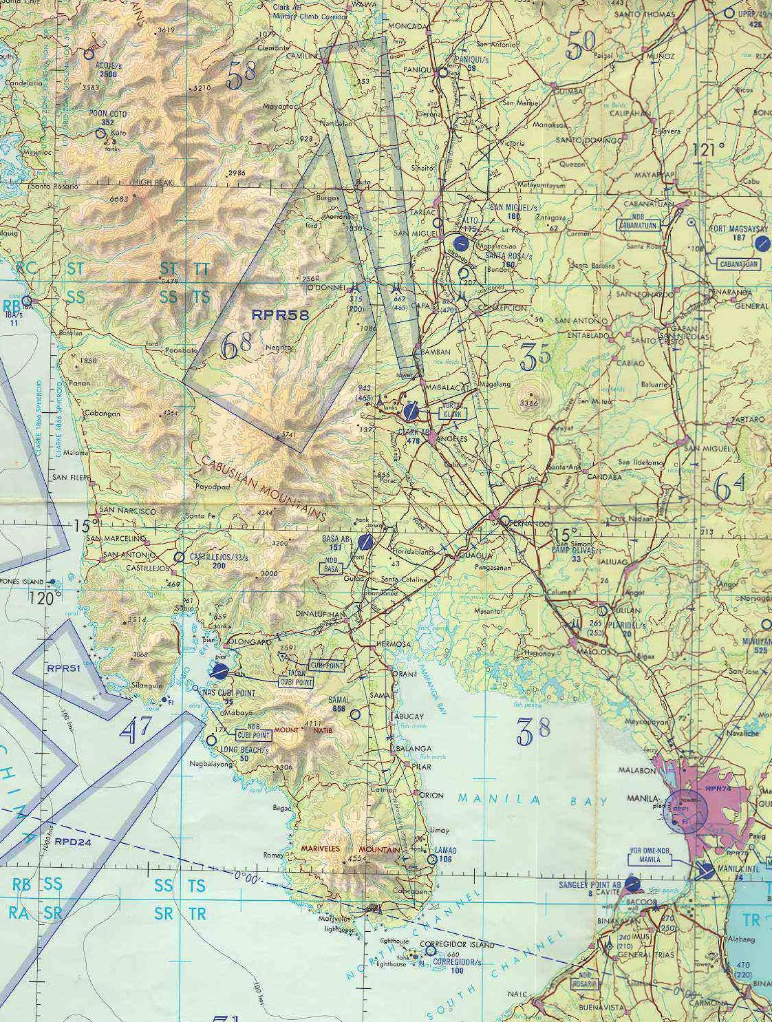
Location map of major U.S. military facilities in the Philippines during the 1970s and 1980s. |
 |
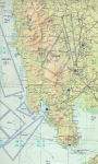
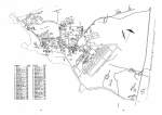
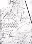
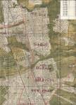
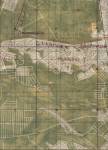
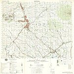
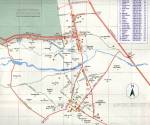
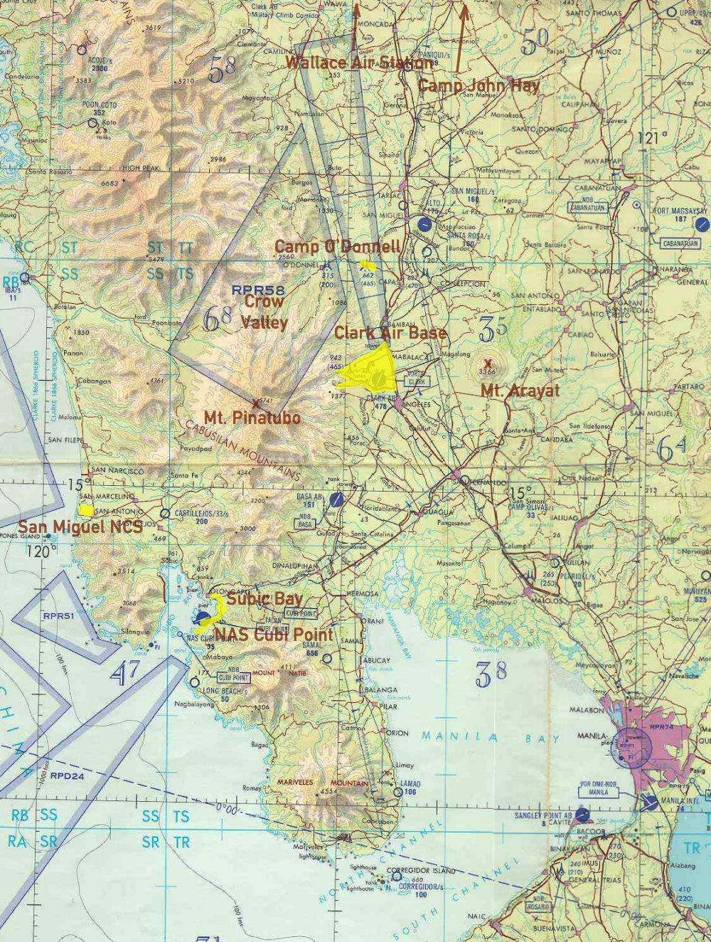
Road map of central Luzon Island from approximately 1965 or 1970.
The North Luzon expressway connecting Angeles to Manila had not yet been built.
|
| Historical base maps |
 |
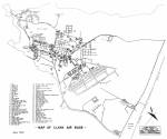
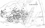
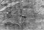
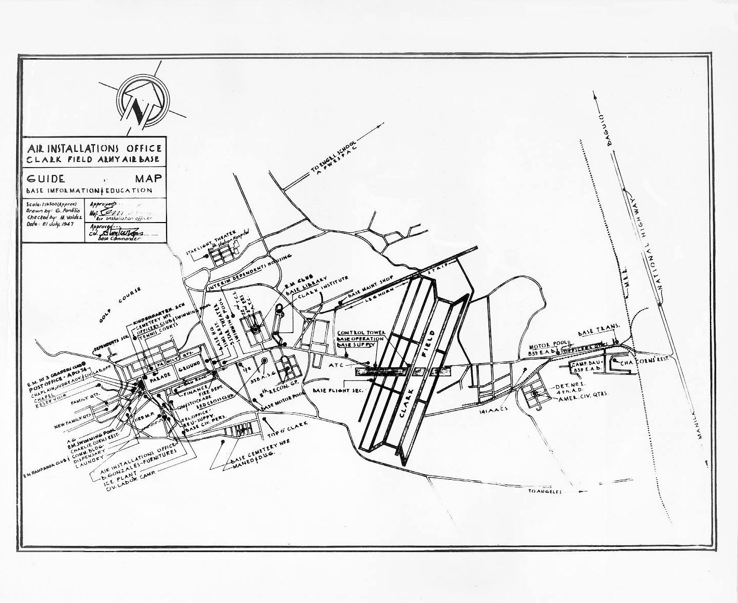
Clark Air Base, 1947. The base had been in Japanese hands a few years earlier. Much
of the base was still centered around the old Fort Stotsenburg on the parade ground. |
 |
Clark Air Base, 1960. This shows the partial completion of the Hill Housing area. |
 |
Clark Air Base, 1961. Presumably the runway length was still rather short; if this map is
accurate it was only about 8000 ft long. |
 |
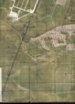
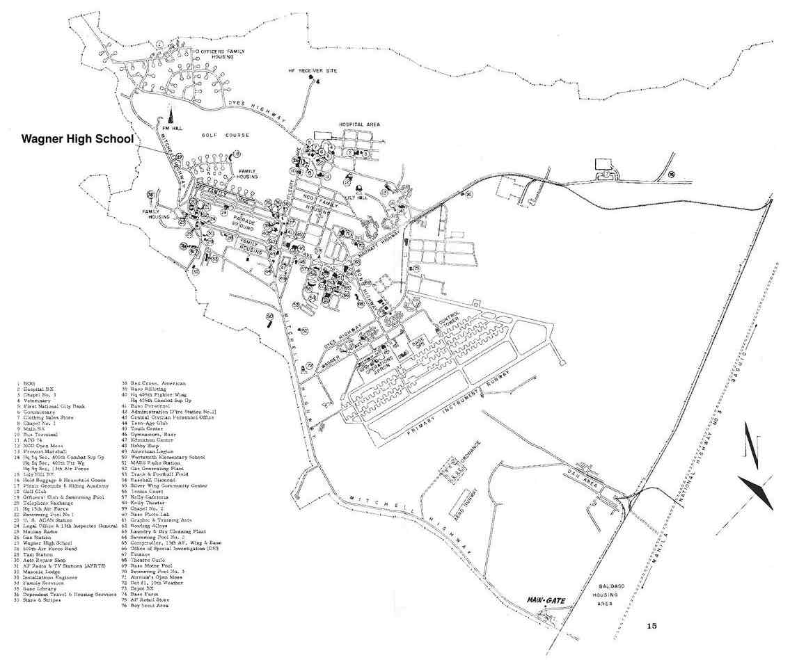
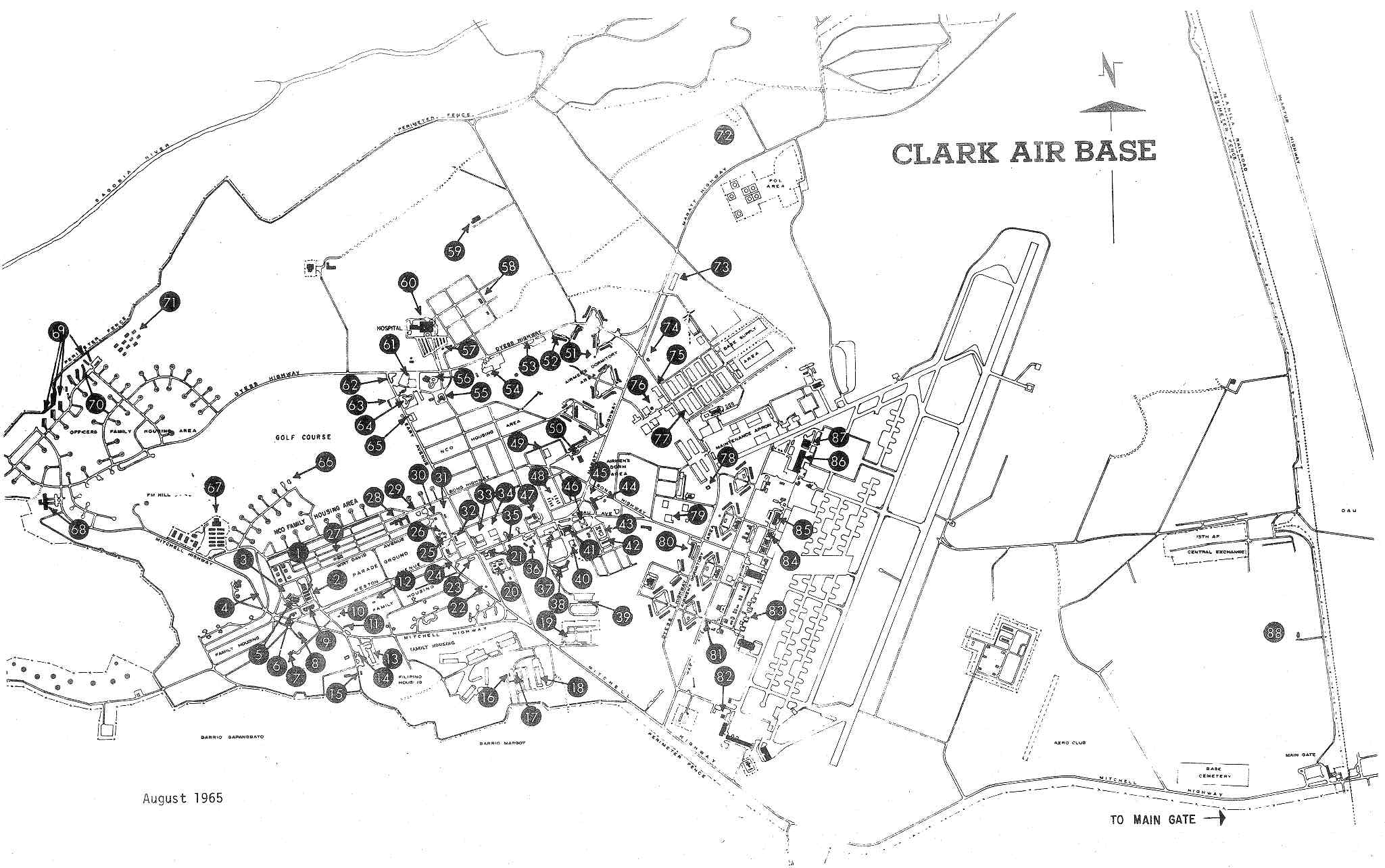
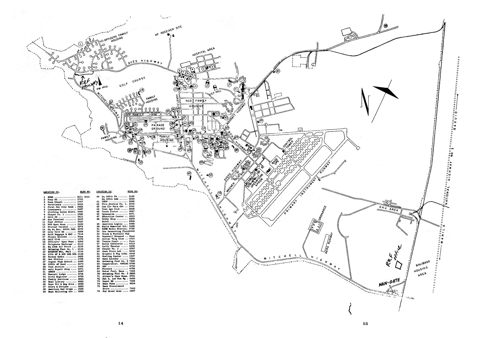
Clark Air Base, 1965. By 1965 the base had taken on the layout that would change little
over the next 25 years. |
 |
Clark Air Base, 1968. The runway dimensions are probably not accurate. |
 |
Clark Air Base, 1971. The base continued to expand and modernize. |
 |
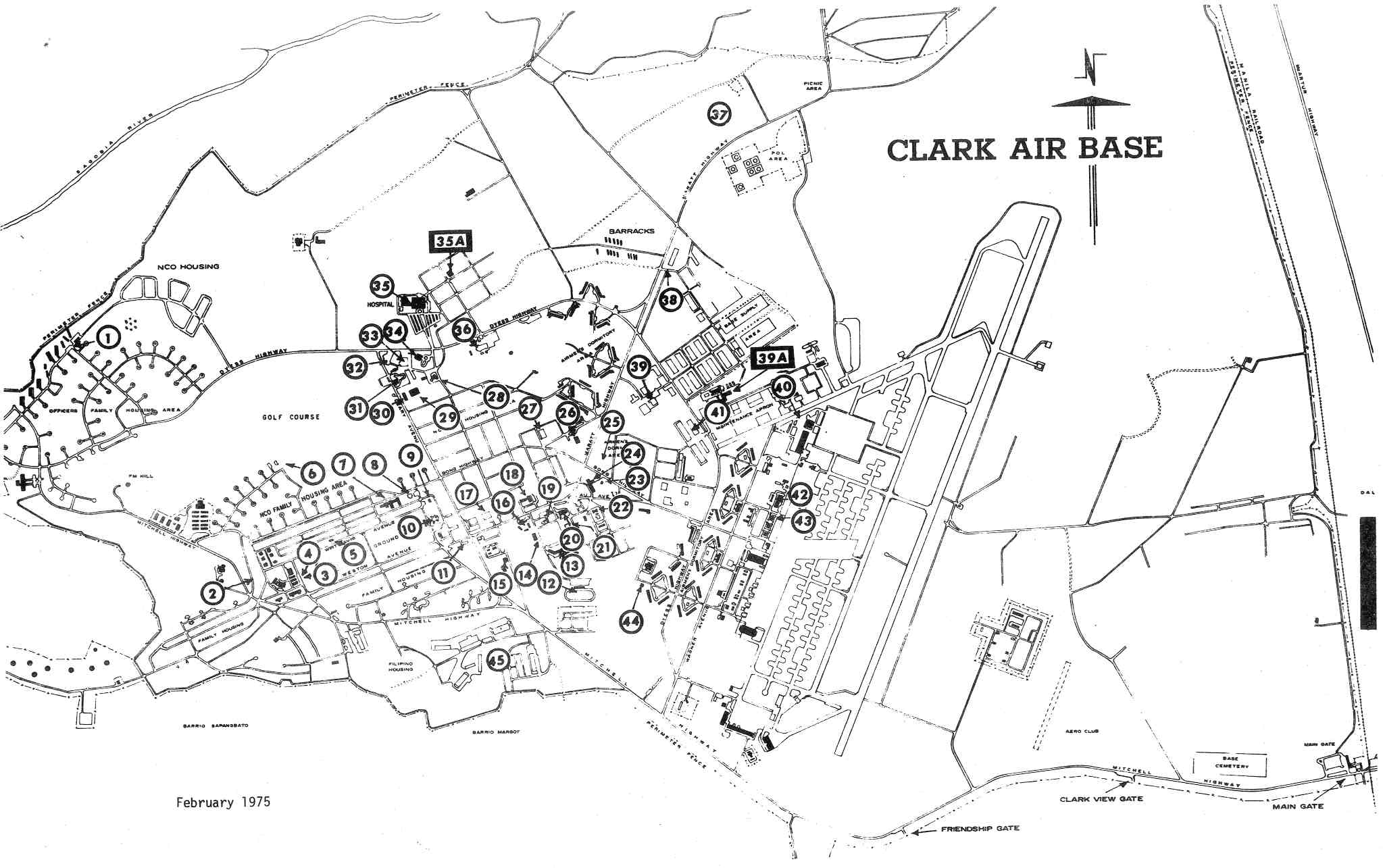
Clark Air Base, 1975. This map shows the completion of the housing area near Wurtsmith Elementary School. |
 |
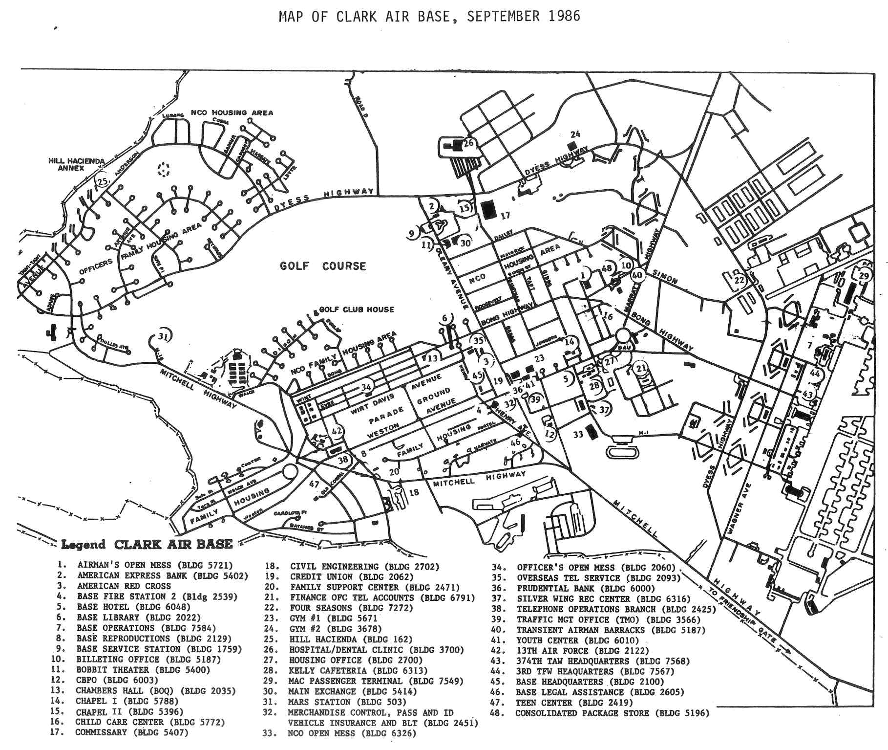
Clark Air Base, 1986. A continued expansion of the Wurtsmith Elementary housing area can be seen. |
| Blueprints & detailed charts |
 |
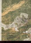
Overview chart showing Clark Air Base and part of Crow Valley and Camp O'Donnell.
(Comprehensive Base Plan, Department of the Air Force, 1970, revised July 1978)
|
 |
Flightline area.
(Comprehensive Base Plan, Department of the Air Force, 1970, revised July 1978) |
 |
Angeles City gate areas.
(Comprehensive Base Plan, Department of the Air Force, 1970, revised July 1978) |
 |
Central base area.
(Comprehensive Base Plan, Department of the Air Force, 1970, revised July 1978) |
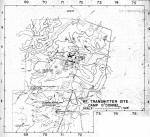 |
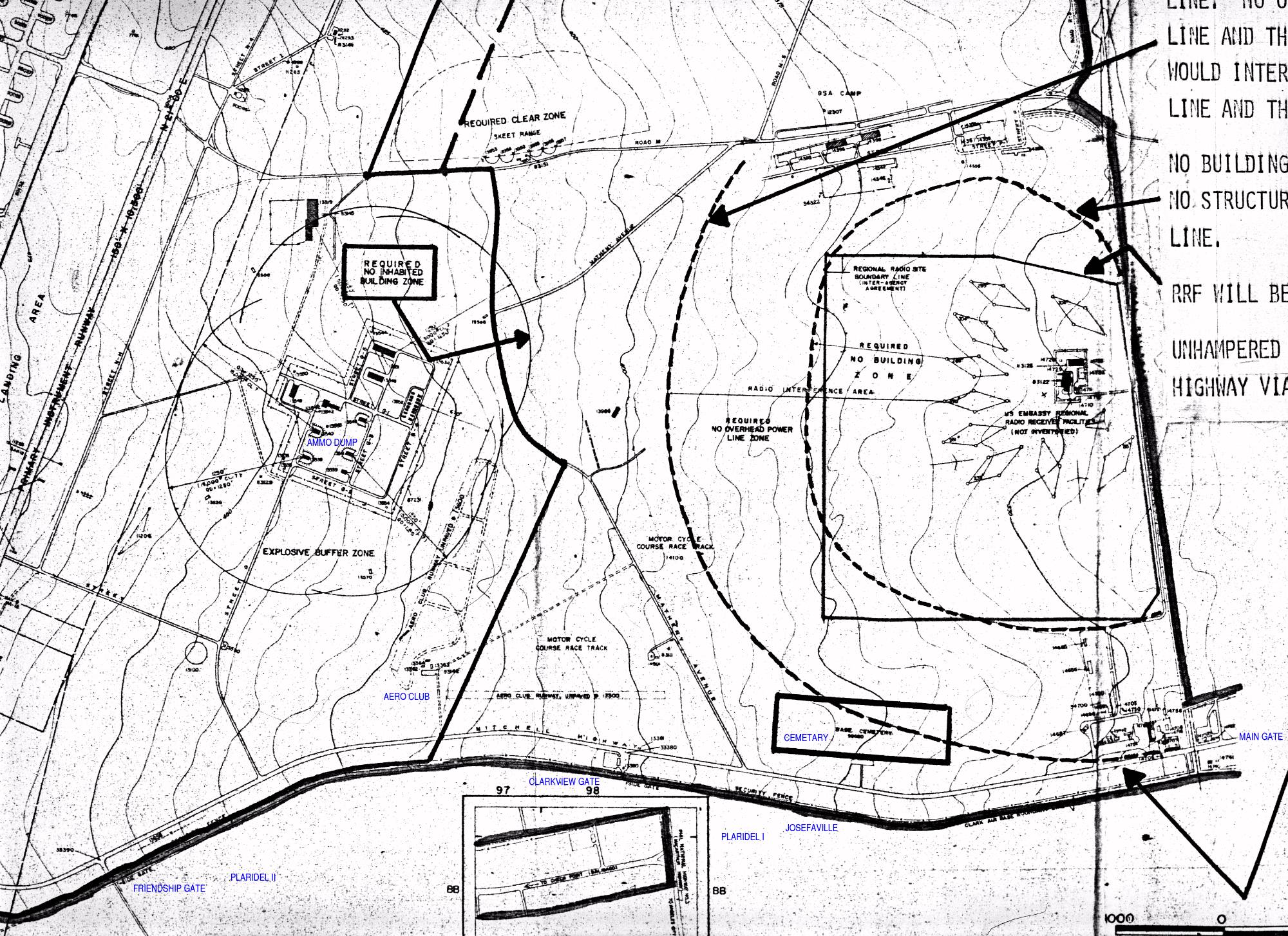
Camp O'Donnell transmitter site about 15 miles north of Clark AB.
(Comprehensive Base Plan, Department of the Air Force, 1970, revised July 1978) |
 |
Hill Housing area on the northwest side of the base.
(Comprehensive Base Plan, Department of the Air Force, 1970, revised July 1978) |
 |
Mabalacat Gate area on the northeast side of the base.
(Comprehensive Base Plan, Department of the Air Force, 1970, revised July 1978) |
 |
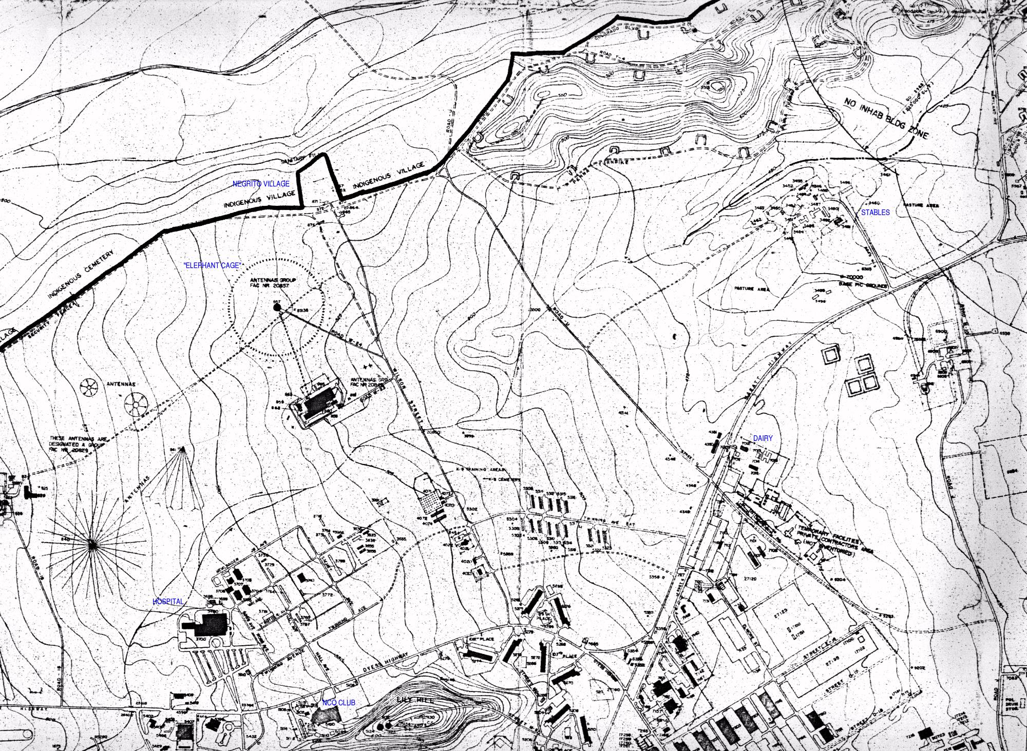
Northern base area which was mostly undeveloped but had weapons storage and stables.
(Comprehensive Base Plan, Department of the Air Force, 1970, revised July 1978) |
 |
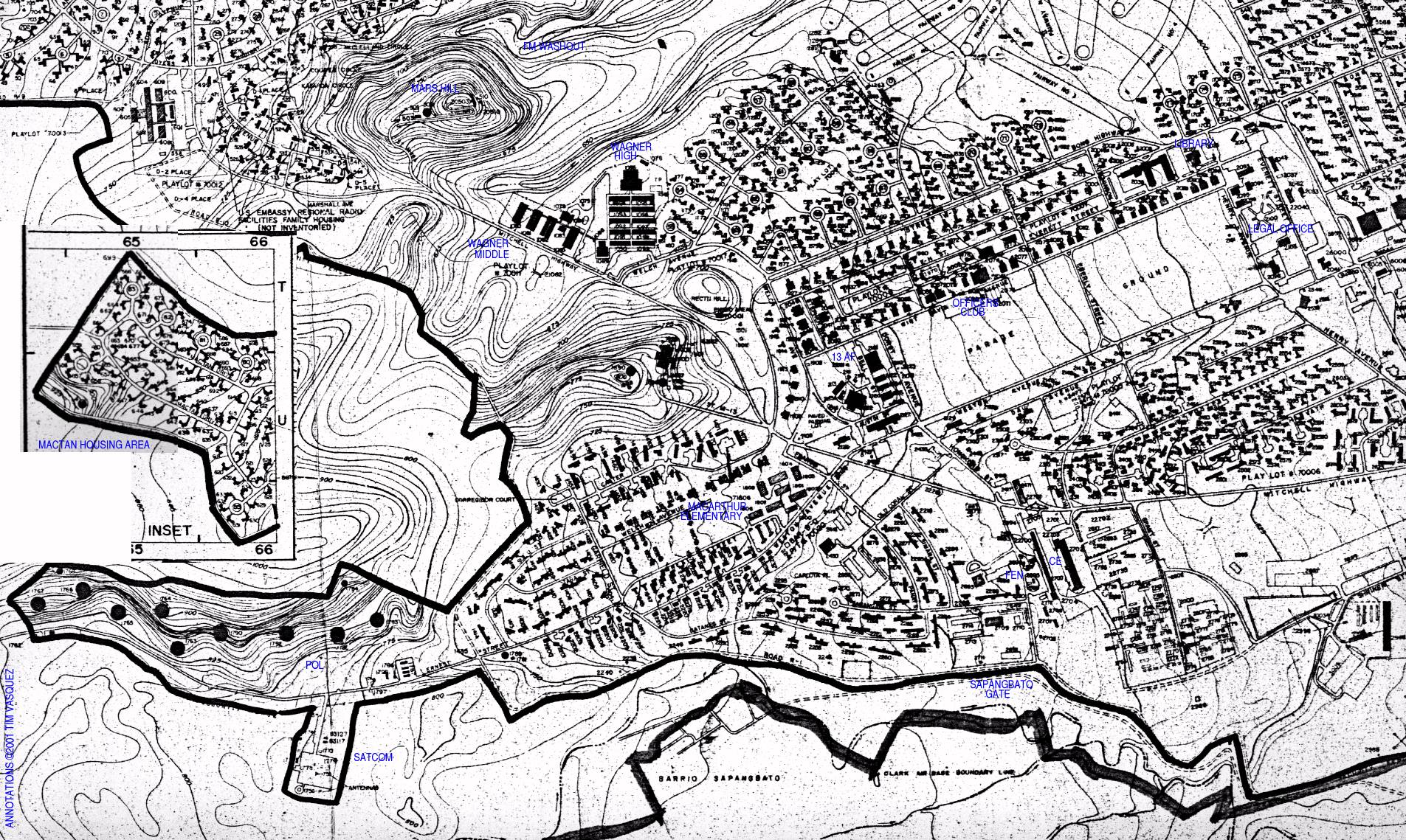
Wagner High School area and parade ground on southwest portion of base.
(Comprehensive Base Plan, Department of the Air Force, 1970, revised July 1978) |
 |
Hill housing area seen on a topographic map.
(Defense Mapping Agency Topographic Center S901 Edition 1, March 1974. 1:12,500) |
 |
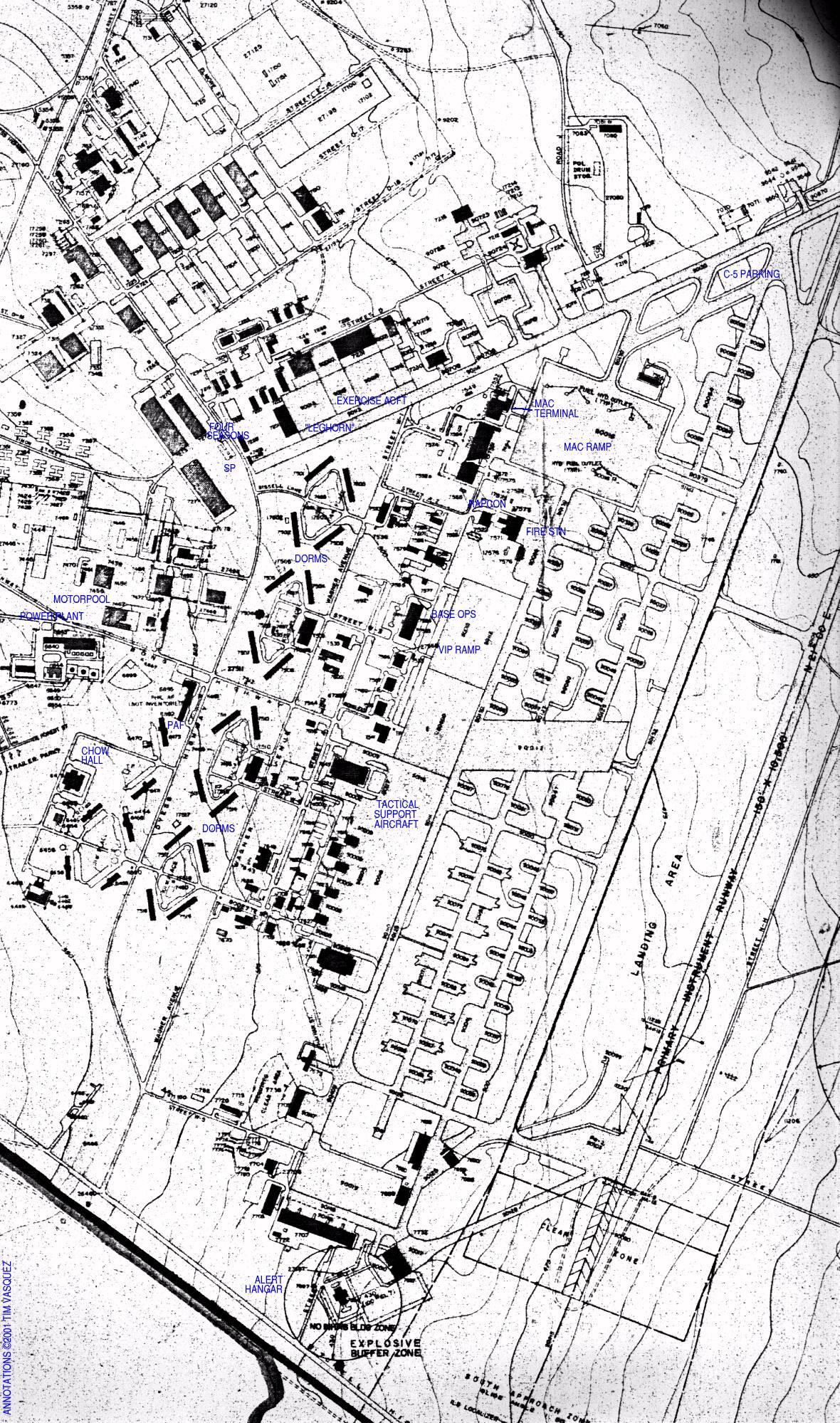
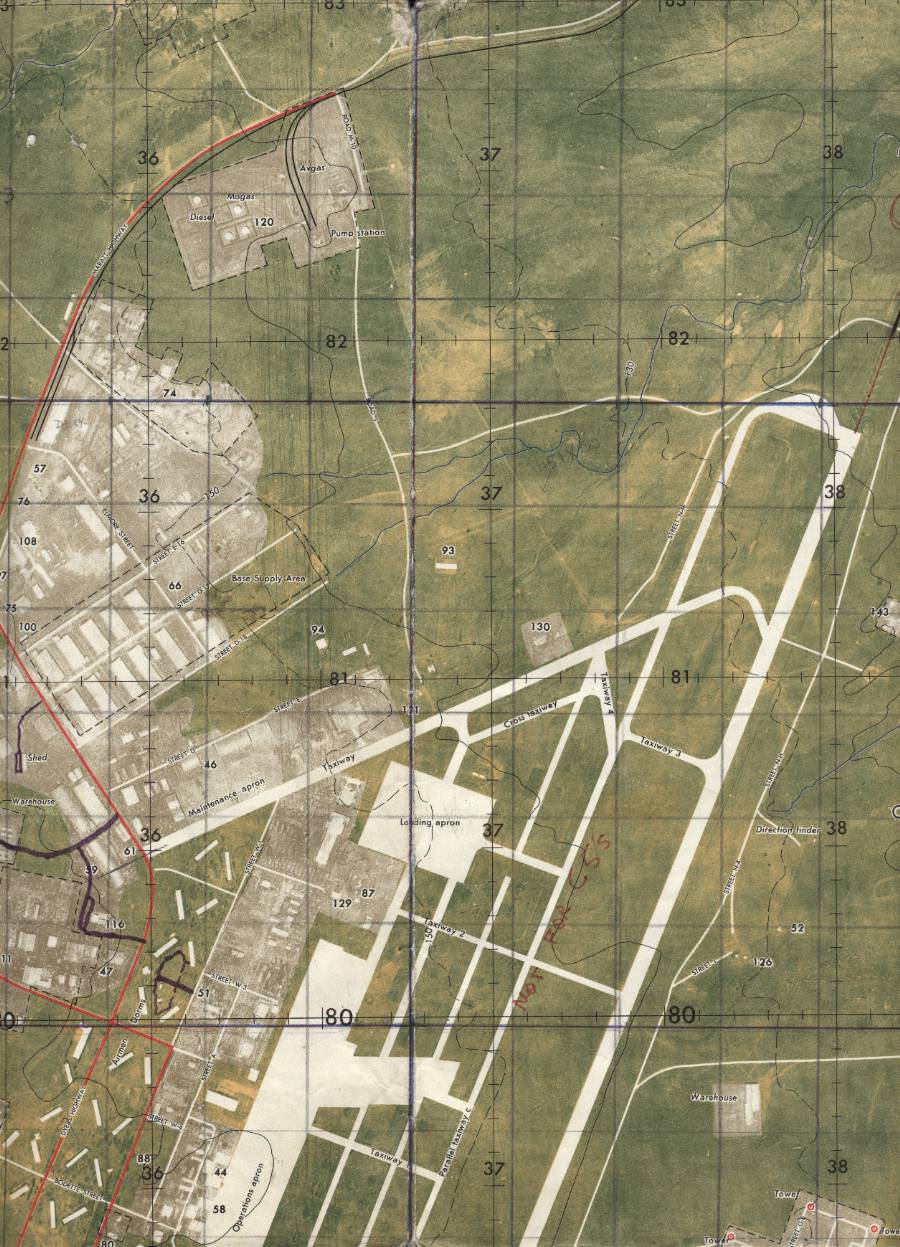
Northern airfield area with the leghorn and MAC Terminal.
(Defense Mapping Agency Topographic Center S901 Edition 1, March 1974. 1:12,500) |
 |
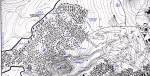
Northern Angeles City area with several subdivisions.
(Defense Mapping Agency Topographic Center S901 Edition 1, March 1974. 1:12,500) |
 |
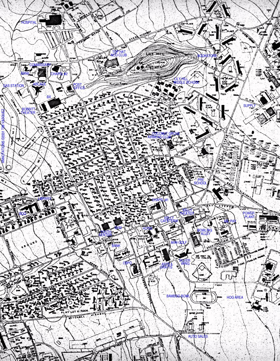
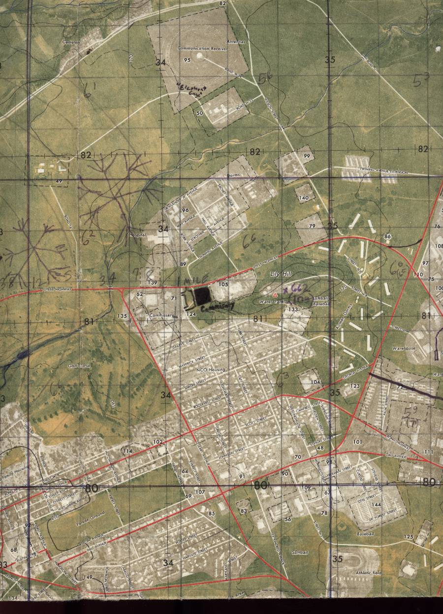
Central base area with parade ground, airmens housing area, and Silver Wing.
(Defense Mapping Agency Topographic Center S901 Edition 1, March 1974. 1:12,500) |
 |
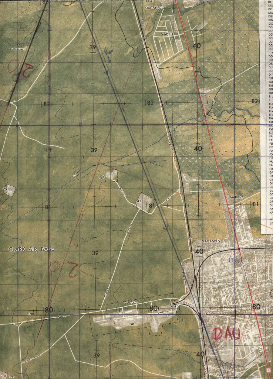
Dau microwave site northeast of the runways.
(Defense Mapping Agency Topographic Center S901 Edition 1, March 1974. 1:12,500) |
 |
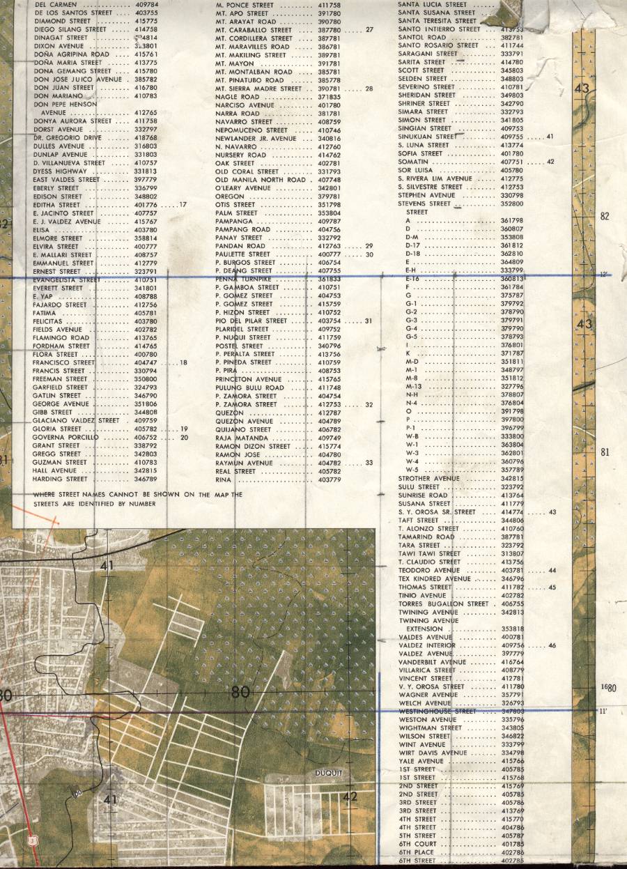
Dau east and part of legend.
(Defense Mapping Agency Topographic Center S901 Edition 1, March 1974. 1:12,500) |
 |
Clark housing gates near Friendship Gate.
(Defense Mapping Agency Topographic Center S901 Edition 1, March 1974. 1:12,500) |
 |
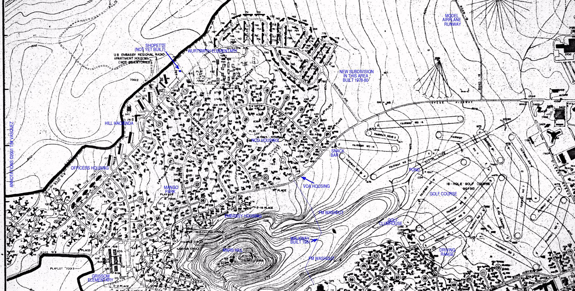
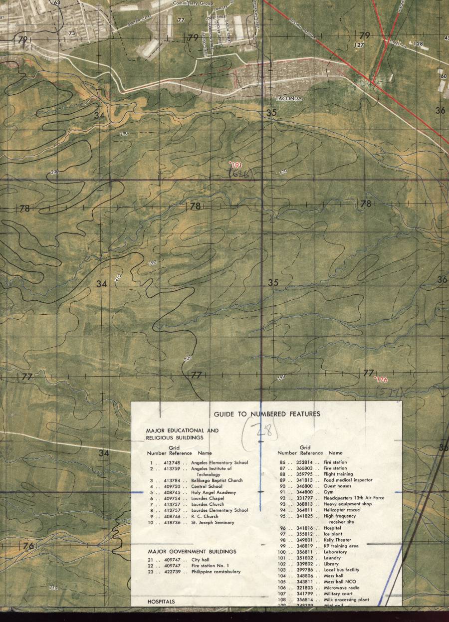
Hill housing area with Grissom Elementary School.
(Defense Mapping Agency Topographic Center S901 Edition 1, March 1974. 1:12,500) |
 |
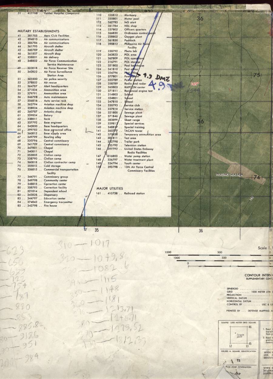
Legend of map.
(Defense Mapping Agency Topographic Center S901 Edition 1, March 1974. 1:12,500) |
 |
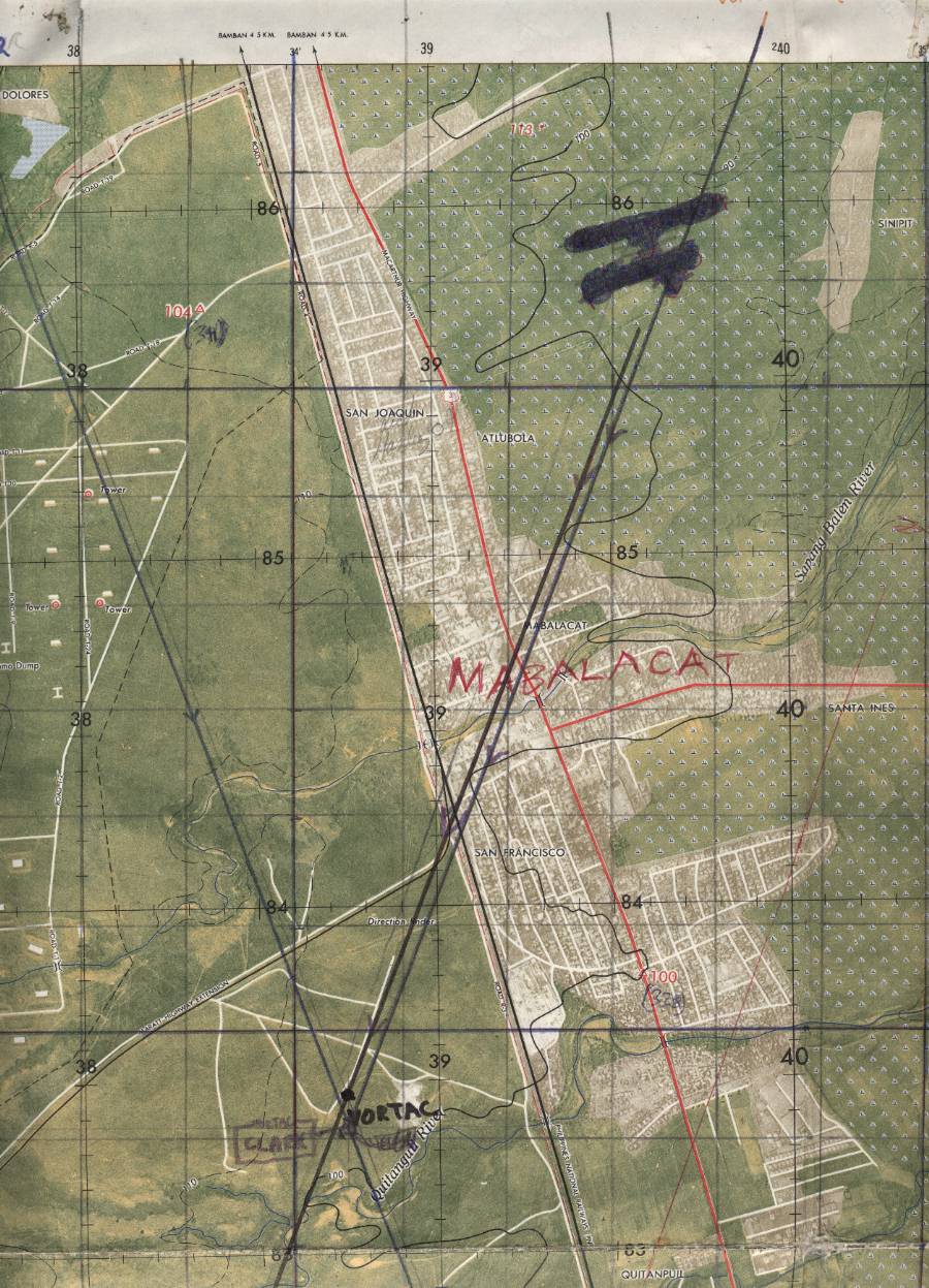
Mabalacat area and Mabalacat Gate.
(Defense Mapping Agency Topographic Center S901 Edition 1, March 1974. 1:12,500) |
 |
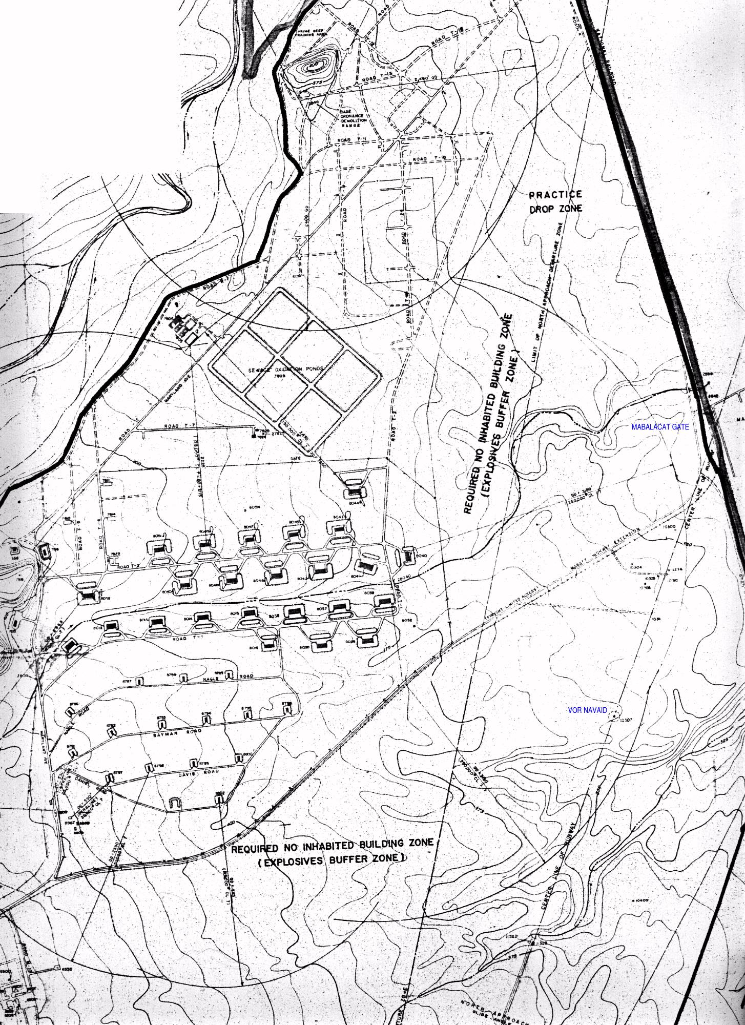
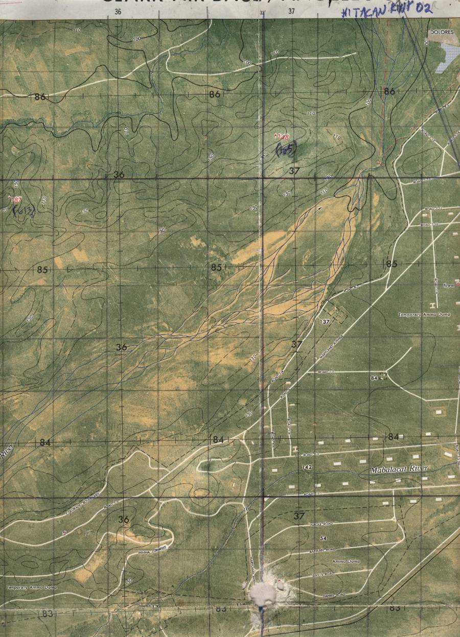
Northern base area with stables and weapons storage.
(Defense Mapping Agency Topographic Center S901 Edition 1, March 1974. 1:12,500) |
 |
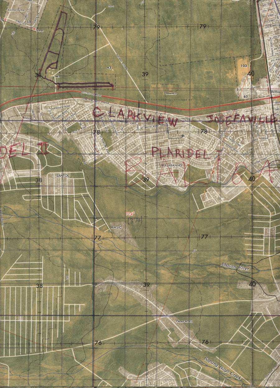
Angeles western housing areas near Clarkview Gate.
(Defense Mapping Agency Topographic Center S901 Edition 1, March 1974. 1:12,500) |
 |
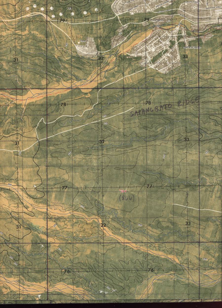
Sapang Bato gate area with SATCOM and POL.
(Defense Mapping Agency Topographic Center S901 Edition 1, March 1974. 1:12,500) |
 |
Southern areas south of CE and 1961st CG.
(Defense Mapping Agency Topographic Center S901 Edition 1, March 1974. 1:12,500) |
 |
Legend listing.
(Defense Mapping Agency Topographic Center S901 Edition 1, March 1974. 1:12,500) |
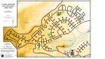 |
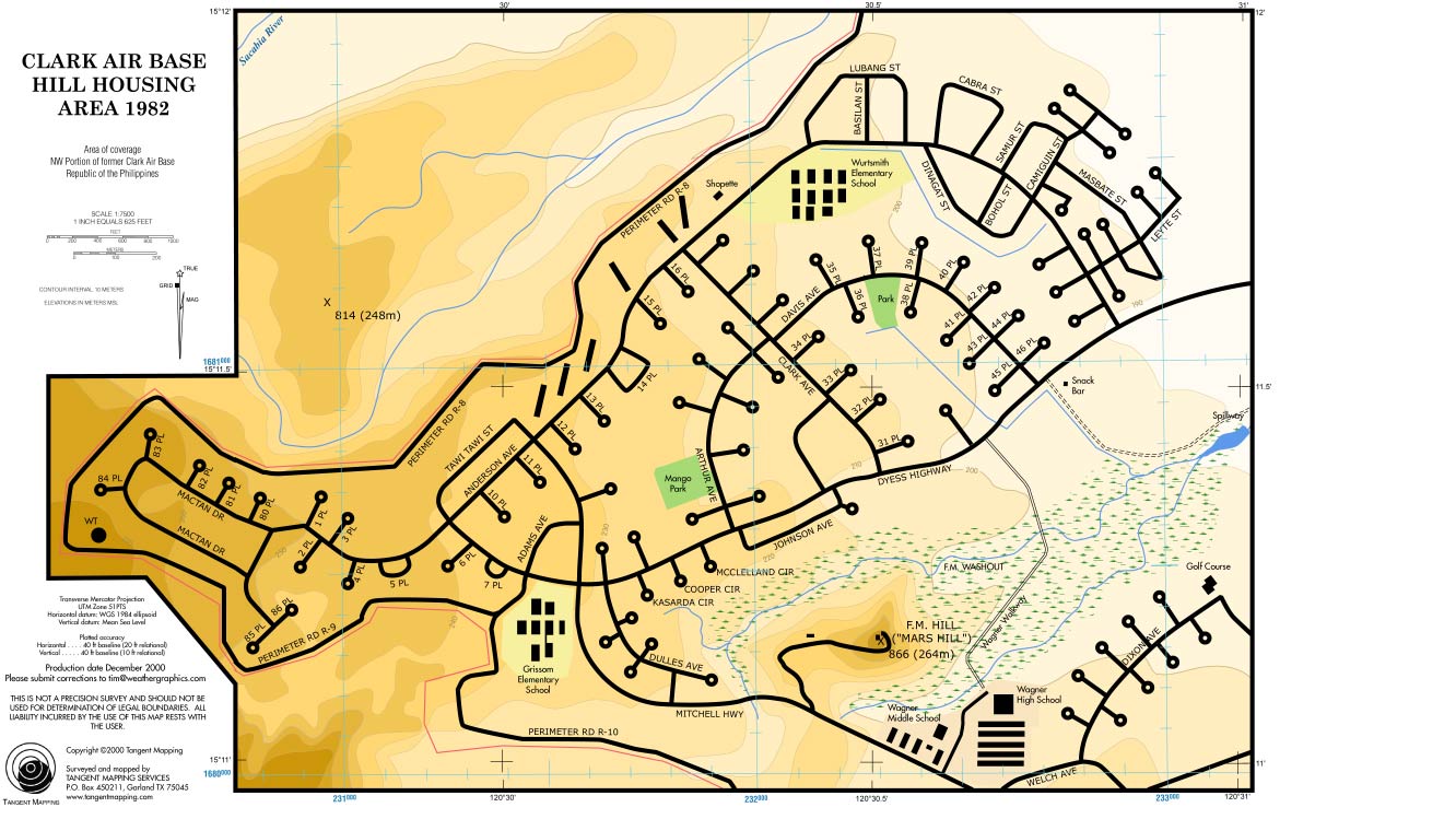
Clark hill housing area map. (ClarkAB.org special) |
 |
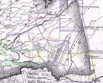
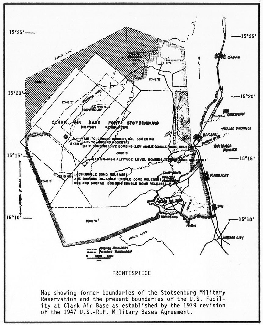
Clark military reservation boundaries as they existed around 1978.
(US Department of Defense) |
 |
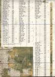
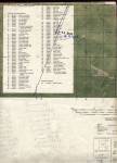
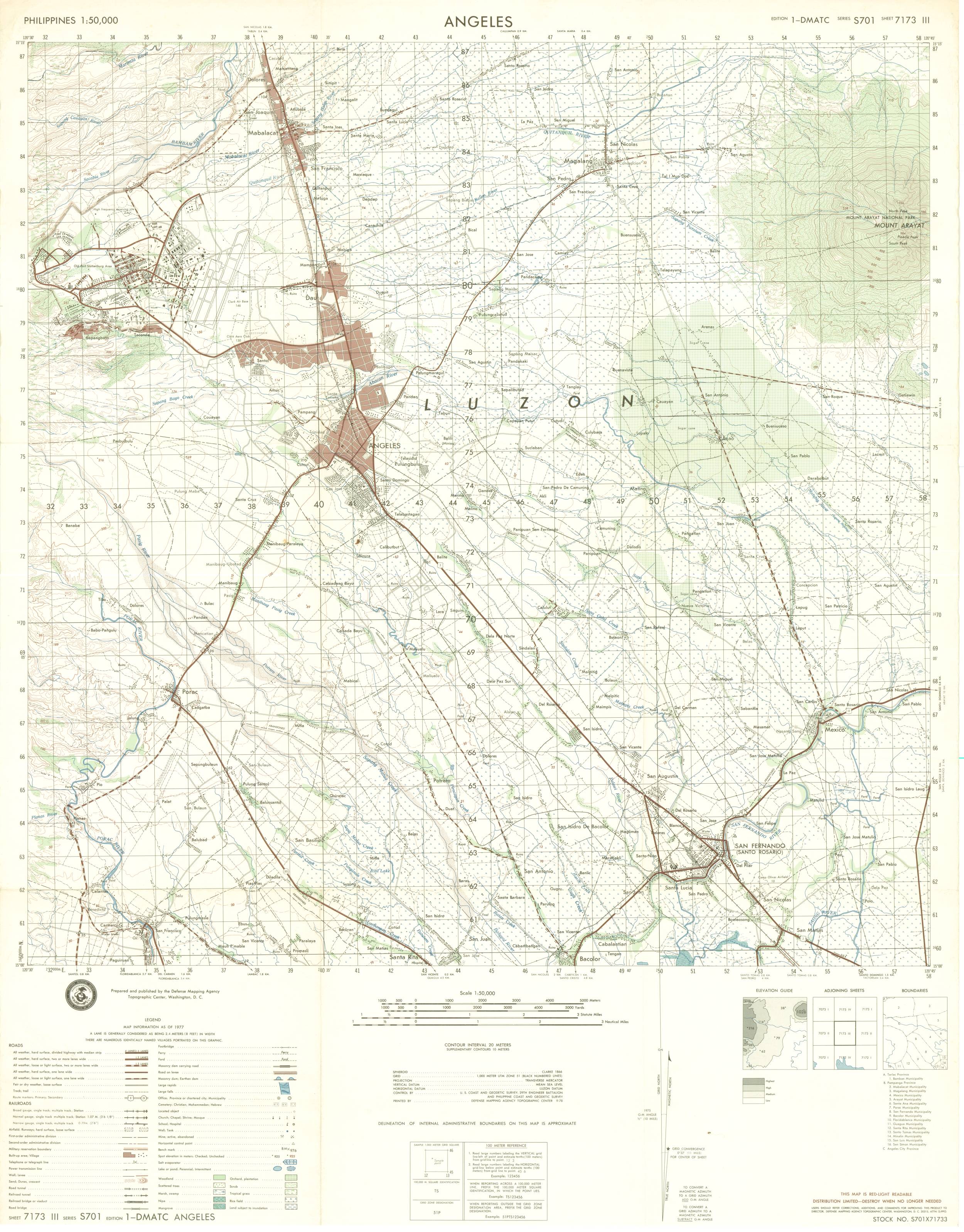
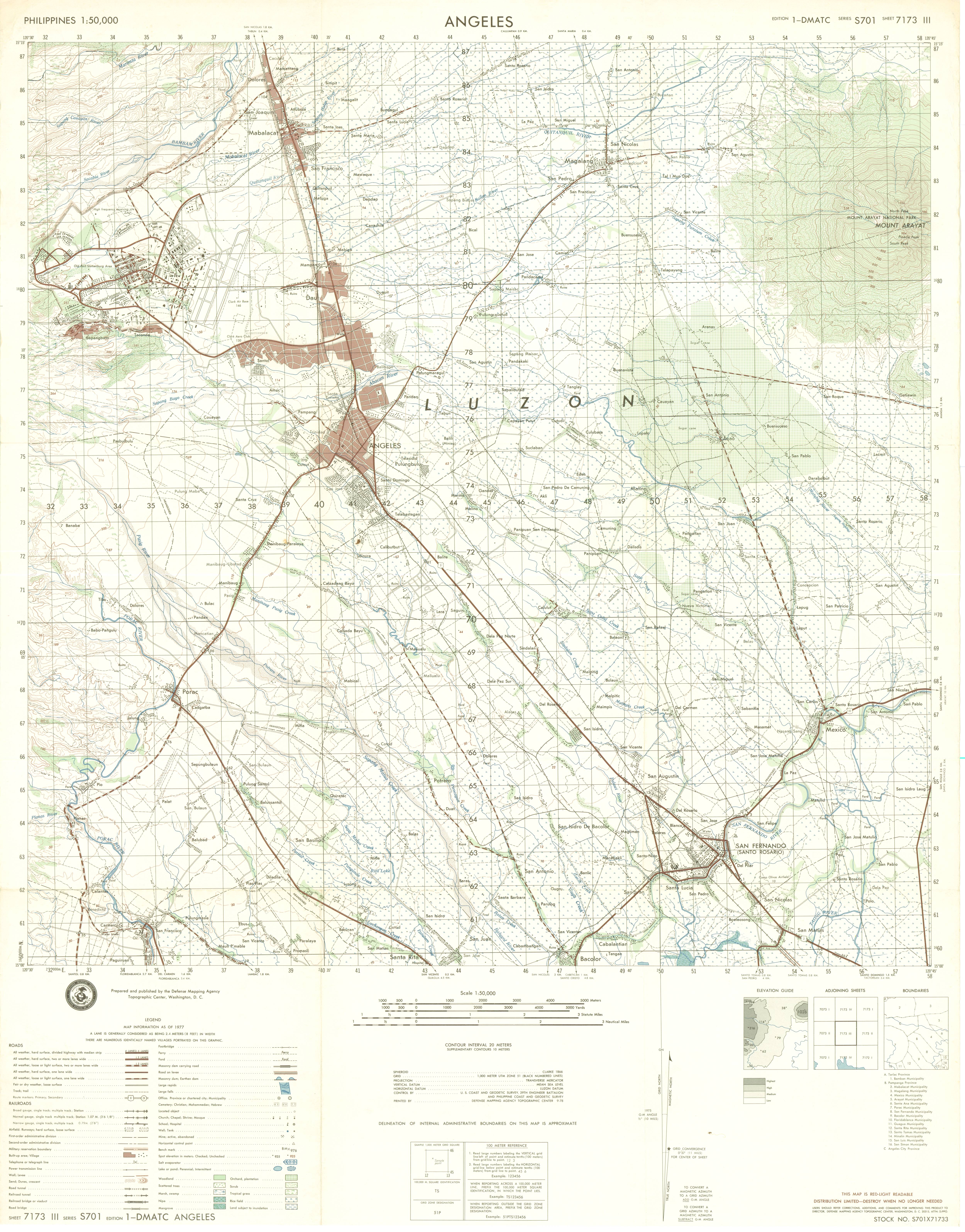
Clark 1:50,000 topographic map, 1977, Series S701, Sheet 7173 III.
Click for high resolution version (5000x6386 px, 4.2 MB) for more detail or the
low resolution version (1250x1596 px, 360 KB) for dialup viewing.
Special thanks to David Riano Madrid for allowing us to borrow this chart and scan it.
(US Department of Defense) |
 |
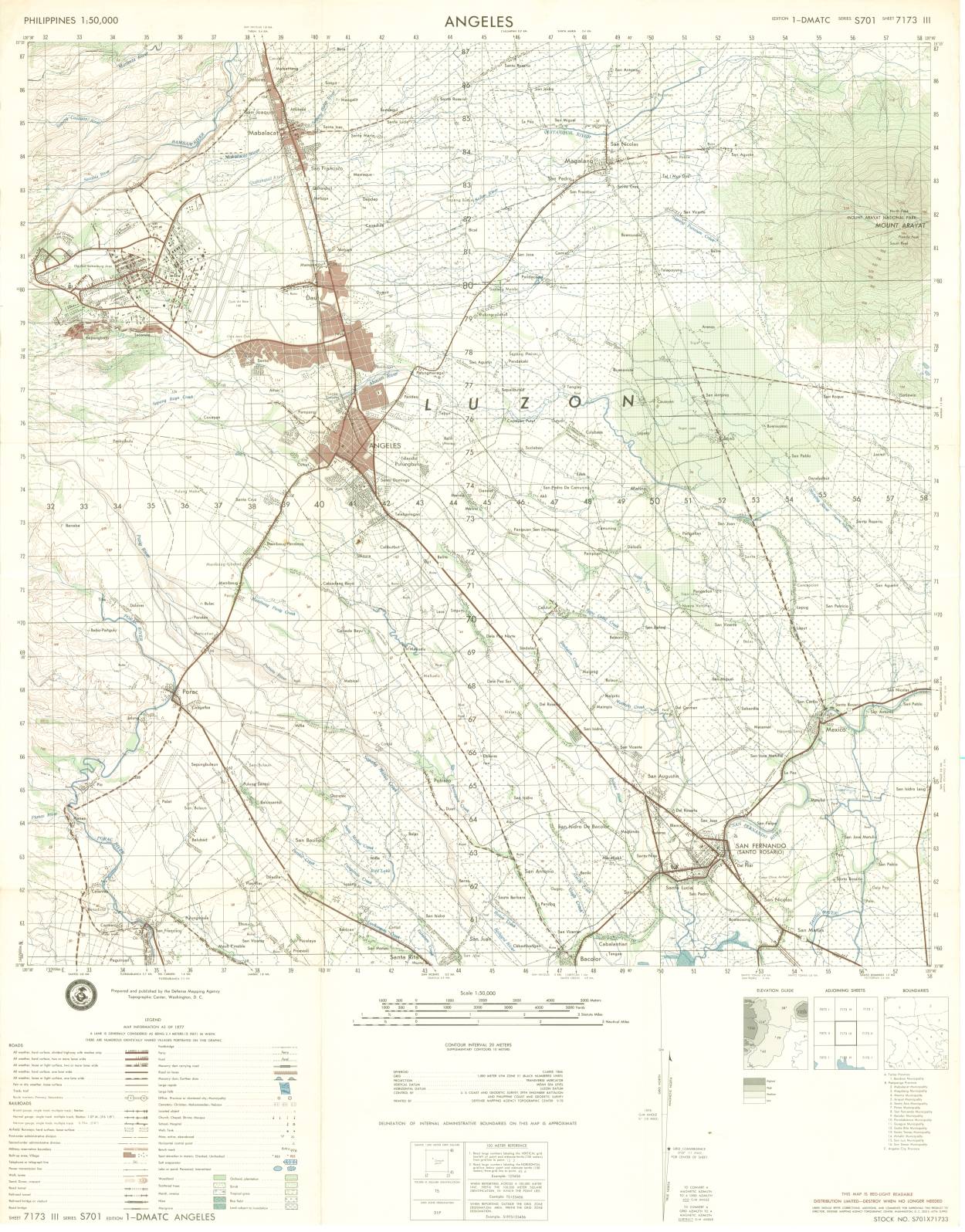
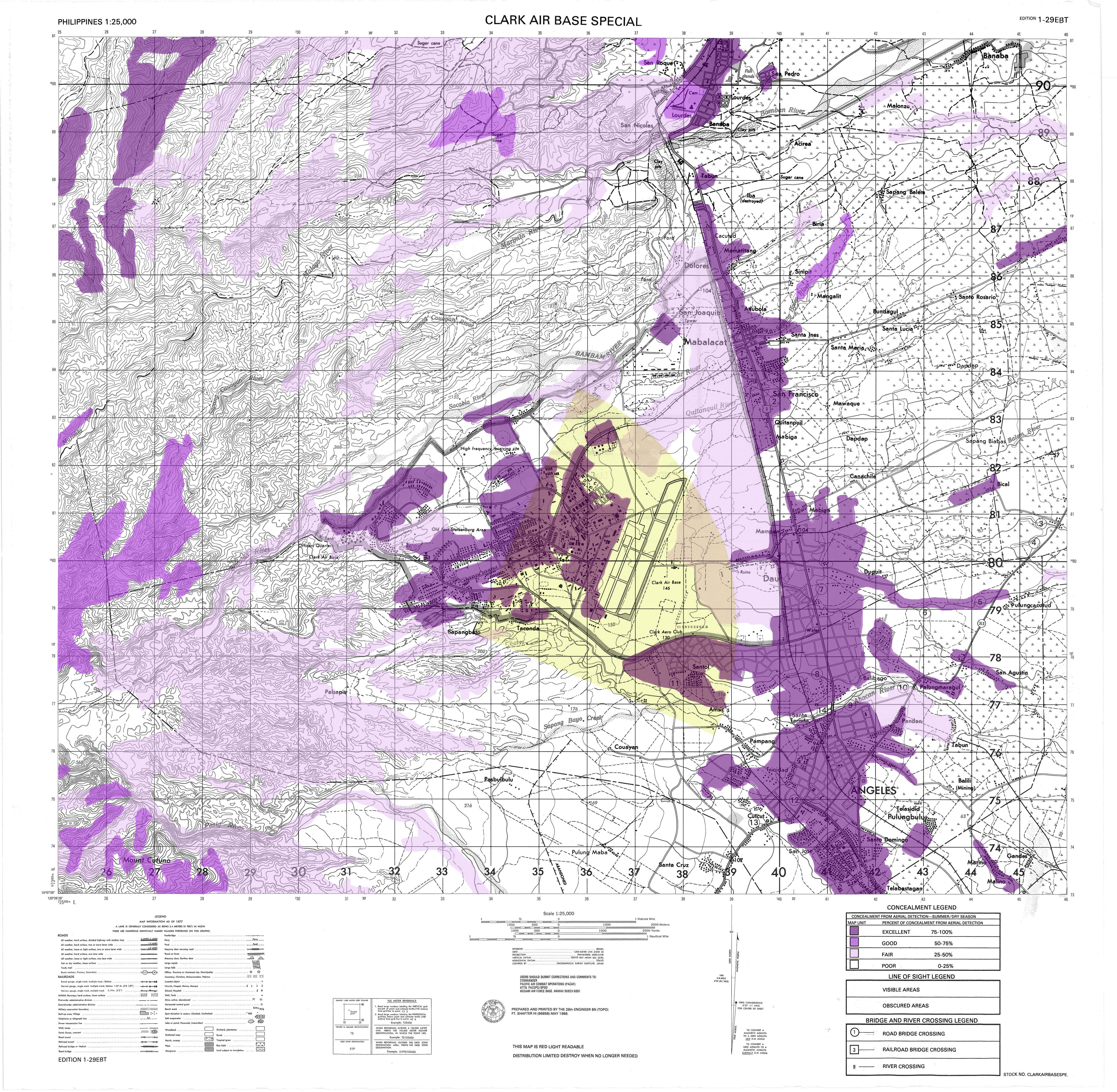
Clark Special DMA map, 1977 presumably used for Special Forces purposes. The basic content is really not any
different from Series S701 (to left) but has more coverage west of the base into the Pinatubo foothills.
Click for high resolution version (5000x4886 px, 5.2 MB) for more detail or the
low resolution version (1250x1221 px, 400 KB) for dialup viewing.
Special thanks to David Riano Madrid for allowing us to borrow this chart and scan it.
(US Department of Defense) |
| Satellite & aerial photos |
 |
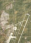
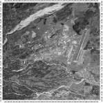
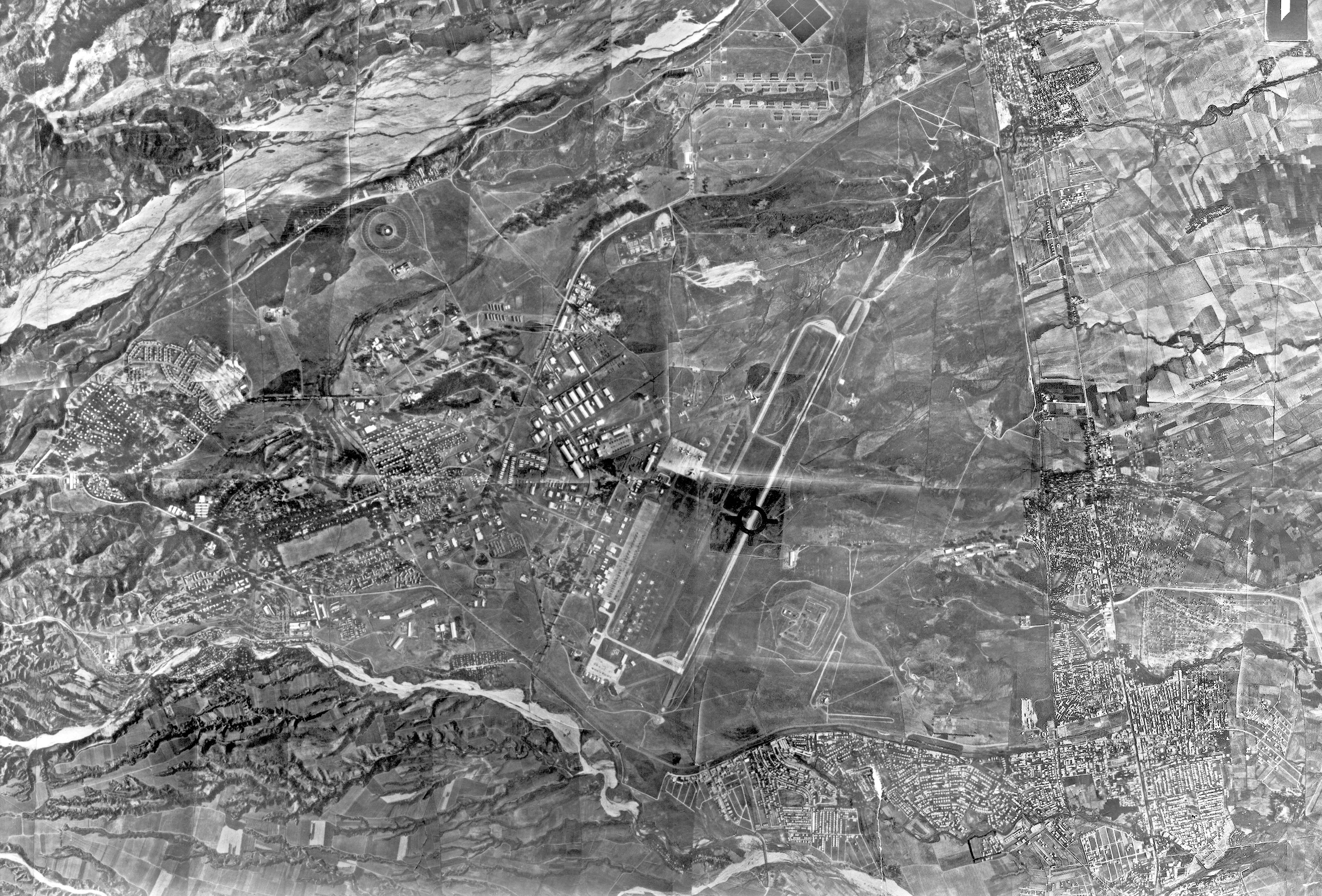
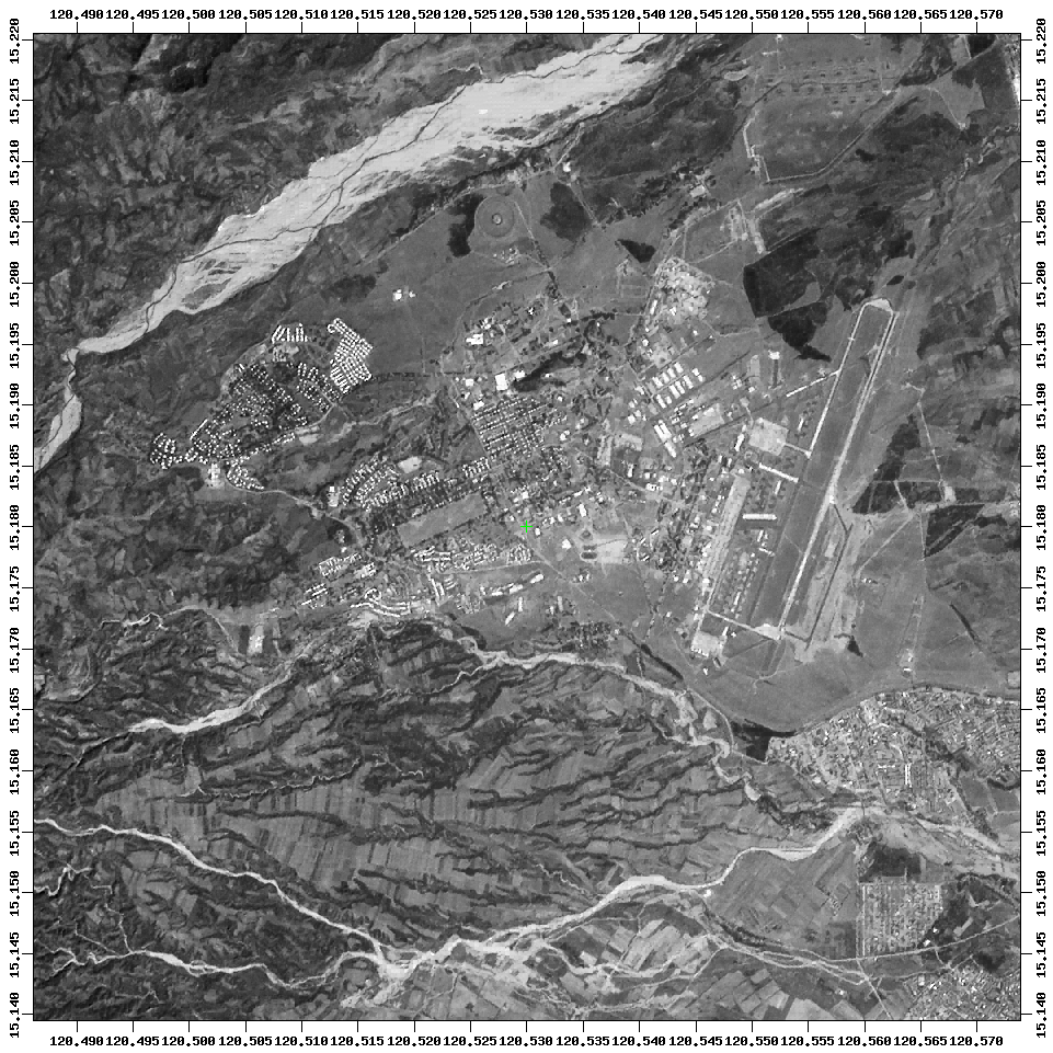
Clark Air Base, 1977 from aerial photos.
(US Air Force) |
 |
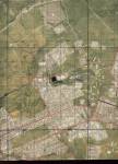
Clark Economic Zone, 1995, a rare shot before massive development work began.
(SPOT, 10 May 1995) |
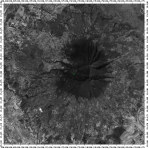 |
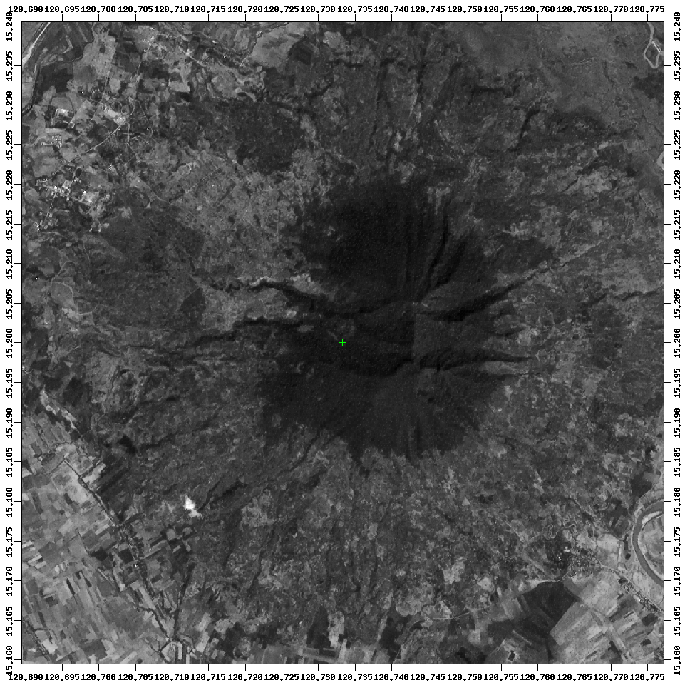
Mt. Arayat volcano, 1995. (SPOT, 10 May 1995) |
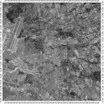 |
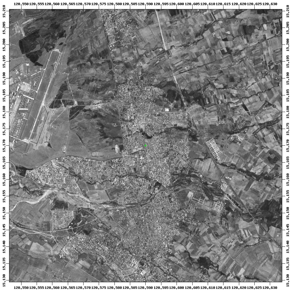
Angeles City, 1995. (SPOT, 10 May 1995) |
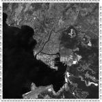 |
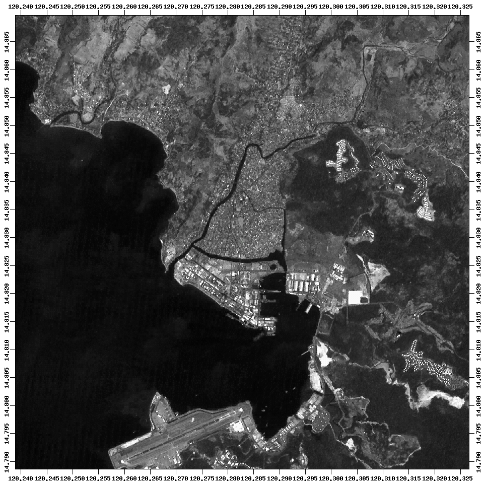
Olongapo City, 1995 near Subic Bay. (SPOT, 10 May 1995) |
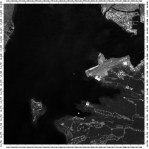 |
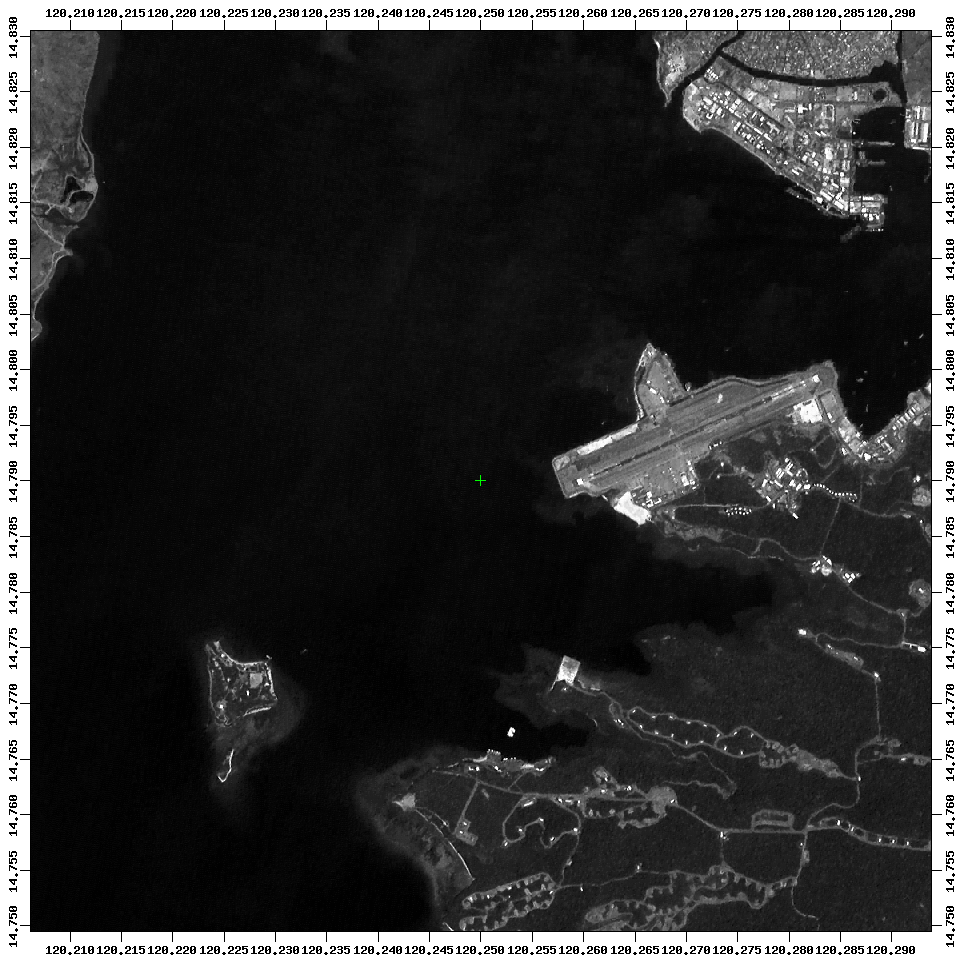
Subic Bay, 1995 before massive development work began. (SPOT, 10 May 1995) |
| Angeles City |
 |
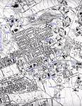
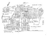
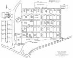
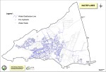
Angeles City map, 1998, showing roads throughout much of the city. |
 |
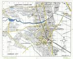
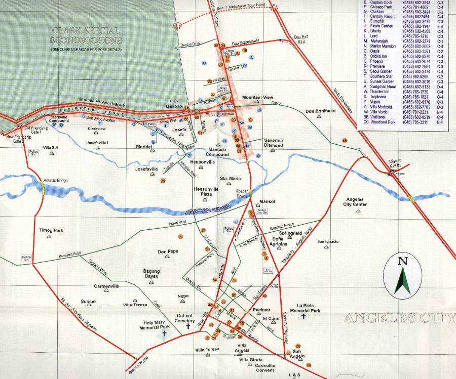
Angeles City road map, 2001. |
 |
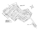
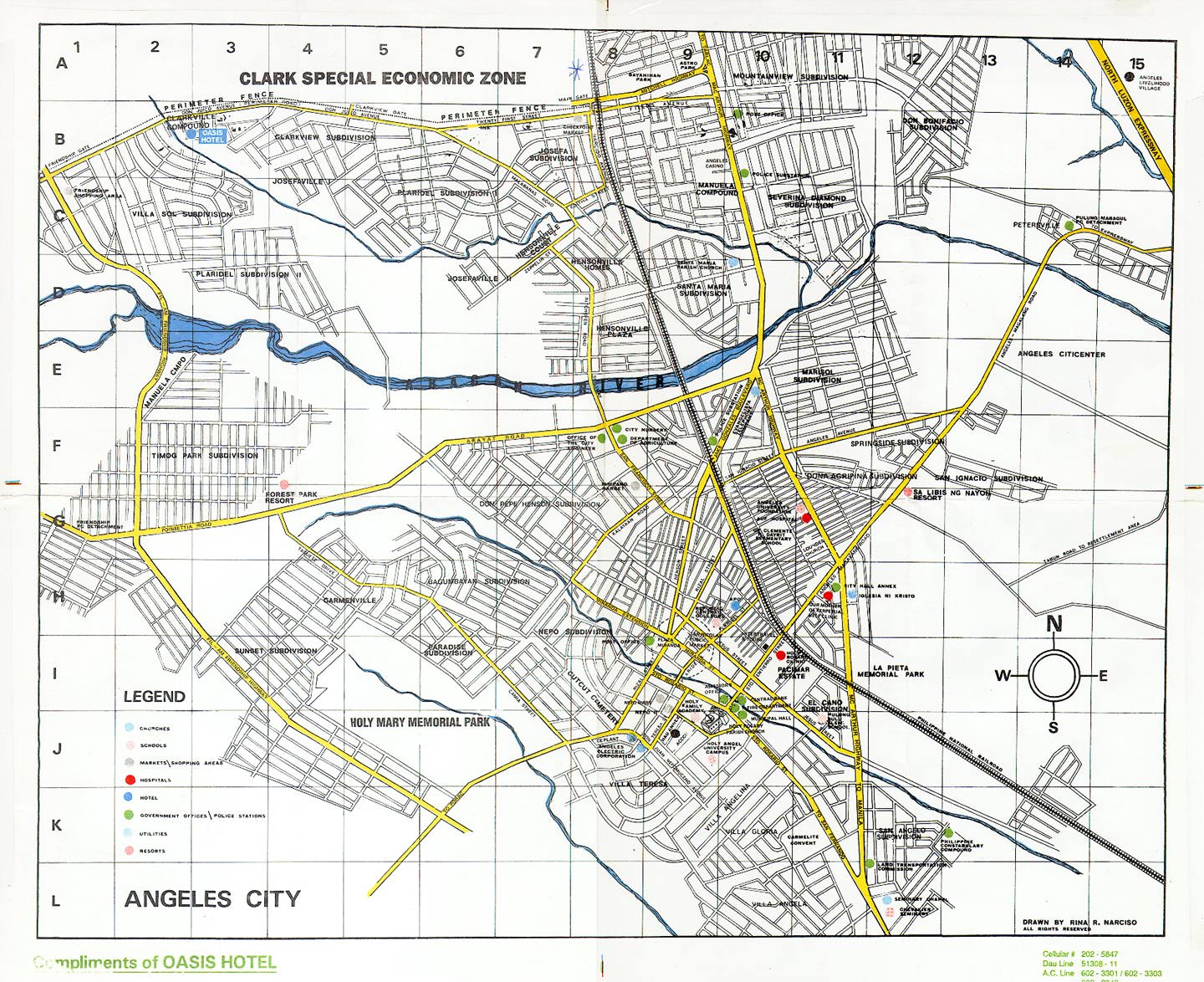
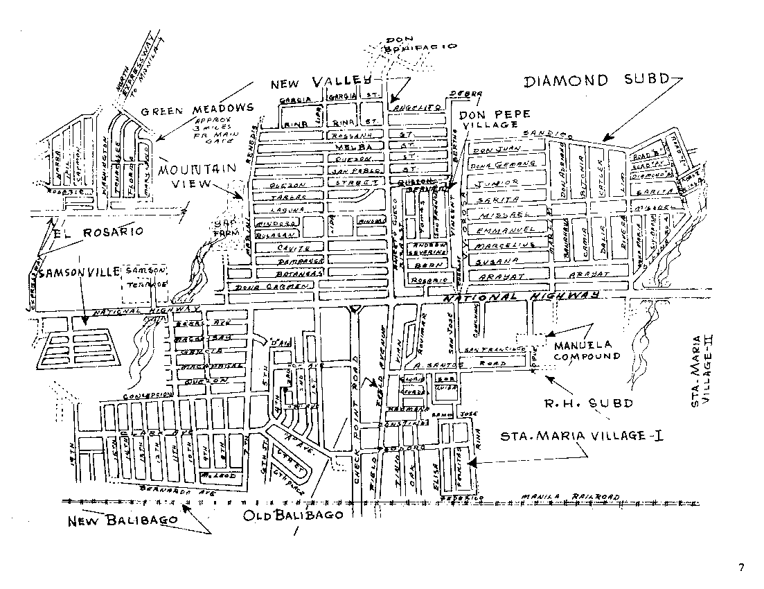
Overview of Angeles City subdivisions, not very good for navigating but fine for figuring
out where one is in relation to another. |
 |
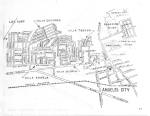
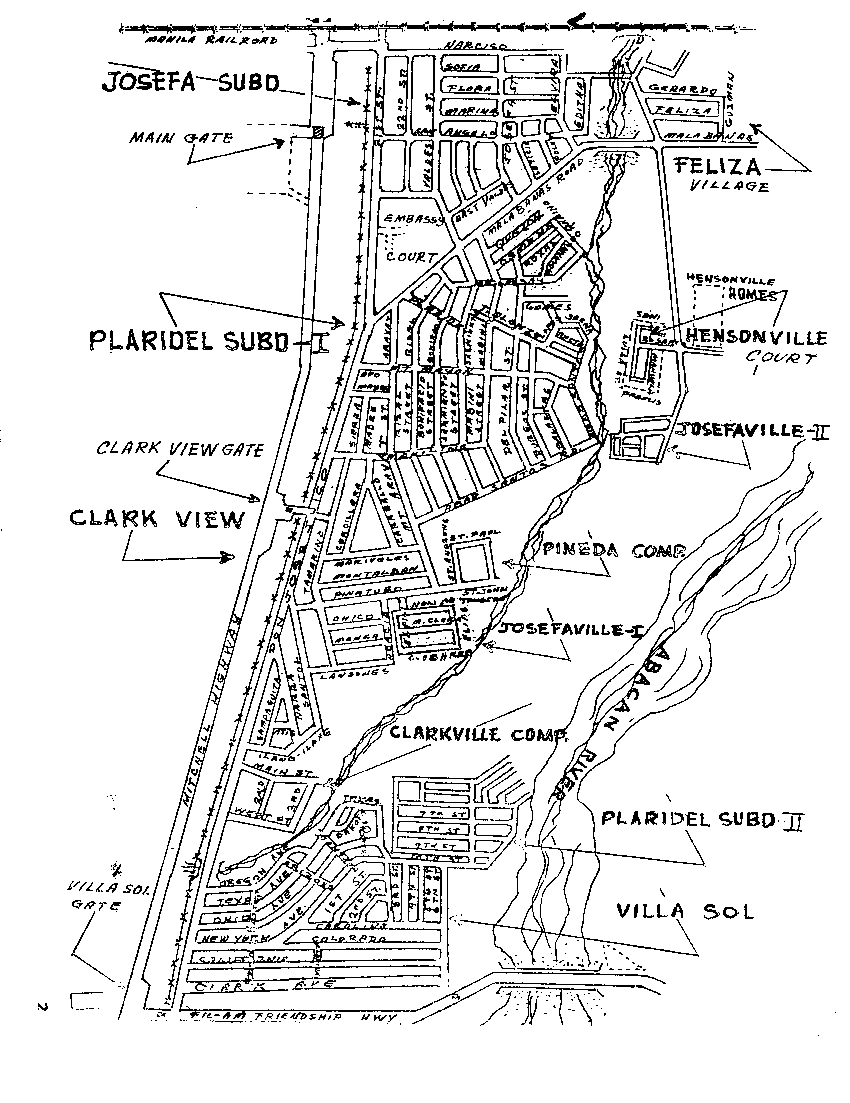
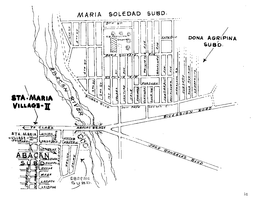
Detailed overview of Angeles City subdivisions, along the Clarkview and Friendship gate areas. |
 |
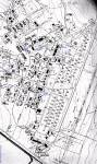
Riverside subdivision, Angeles City. |
 |
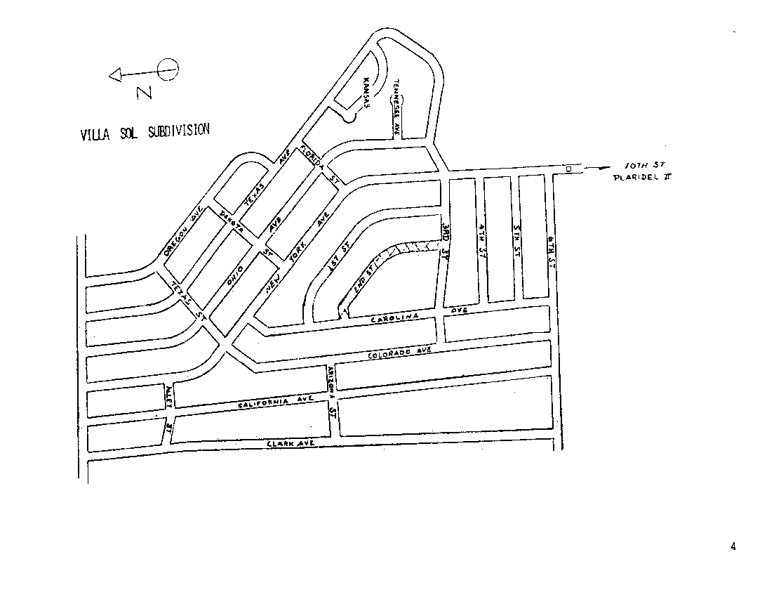
Villa Sol subdivision, Angeles City. |
 |
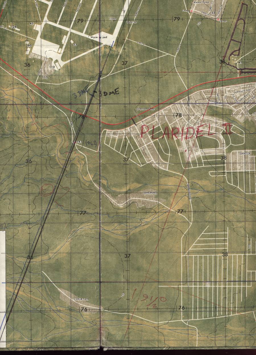
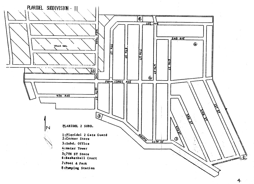
Plaridel subdivision, Angeles City. |
 |
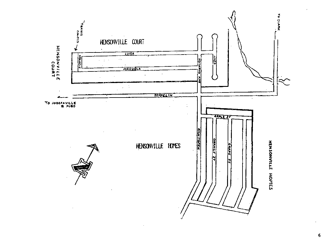
Hensonville subdivision, Angeles City. |
 |
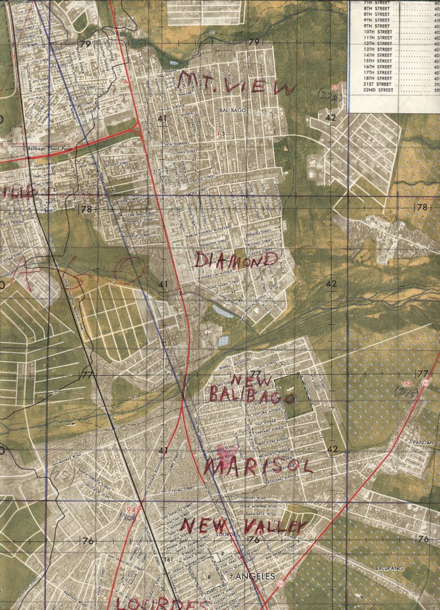
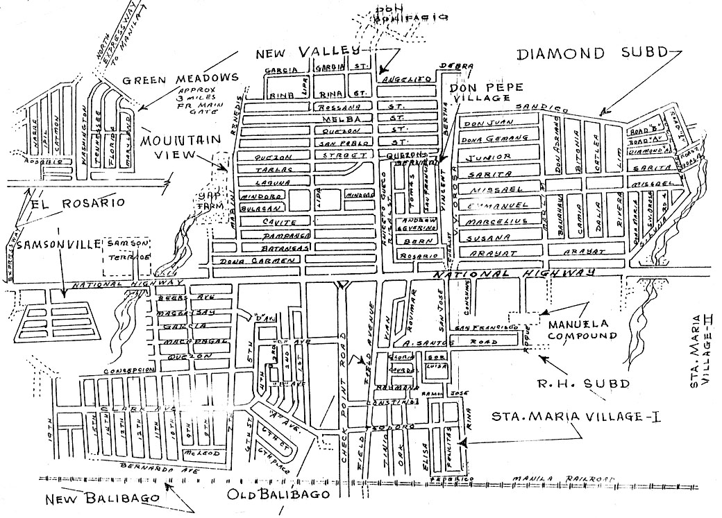
Balibago and Mountain View housing area, Angeles City. |
 |
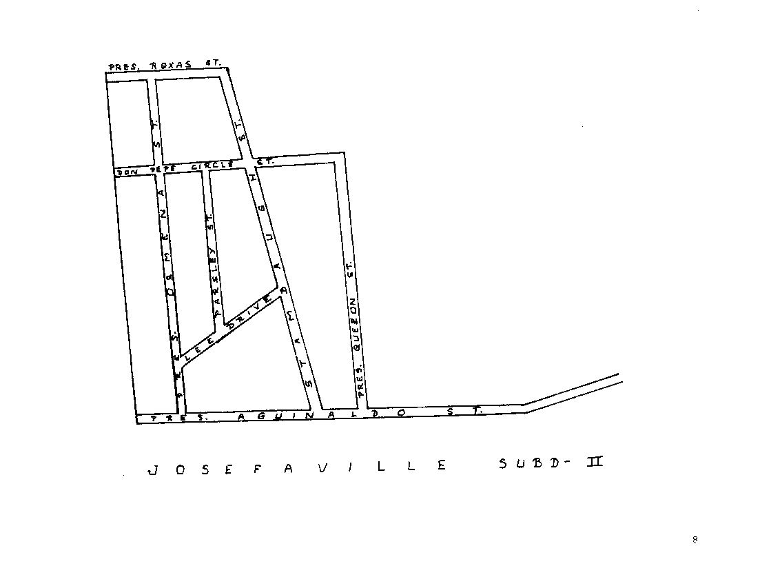
Josefa housing area, Angeles City. |
 |
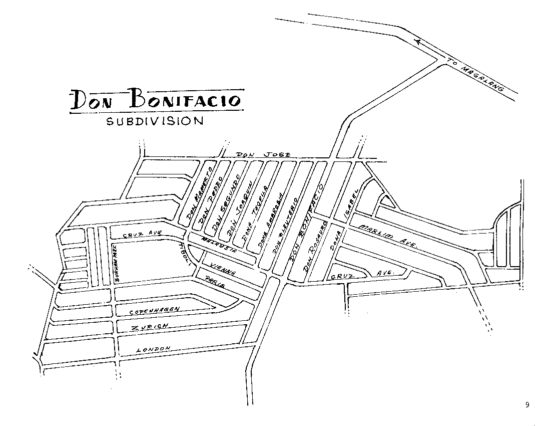
Don Bonifacio subdivision, Angeles City. |
 |
Marisol subdivision, Angeles City. |
 |
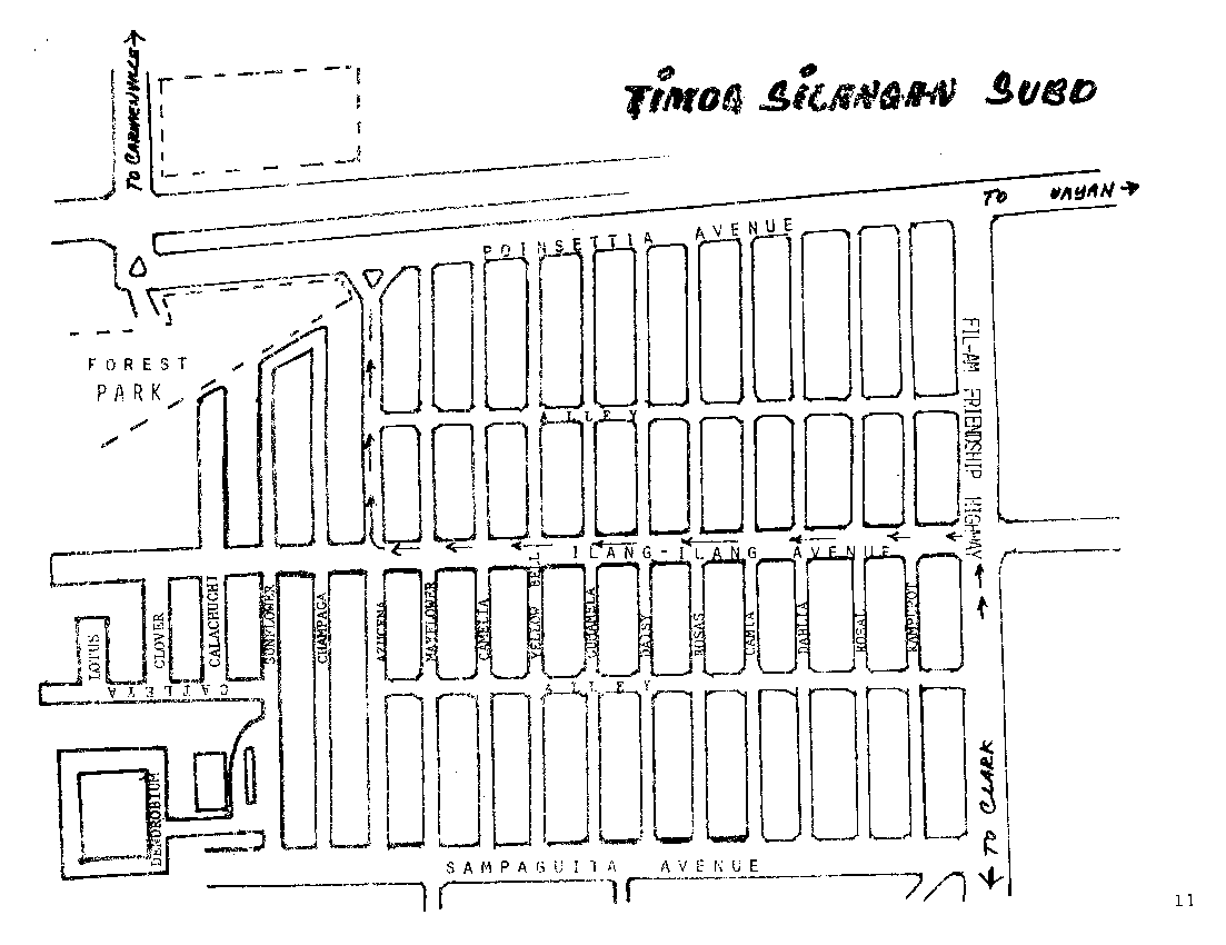
Timog Park subdivision, Angeles City. |
 |
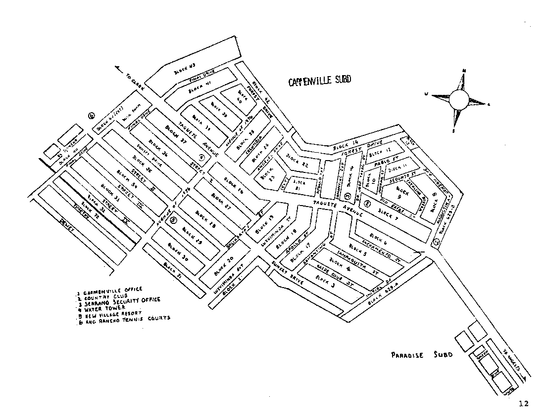
Carmenville subdivision, Angeles City. |
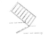 |
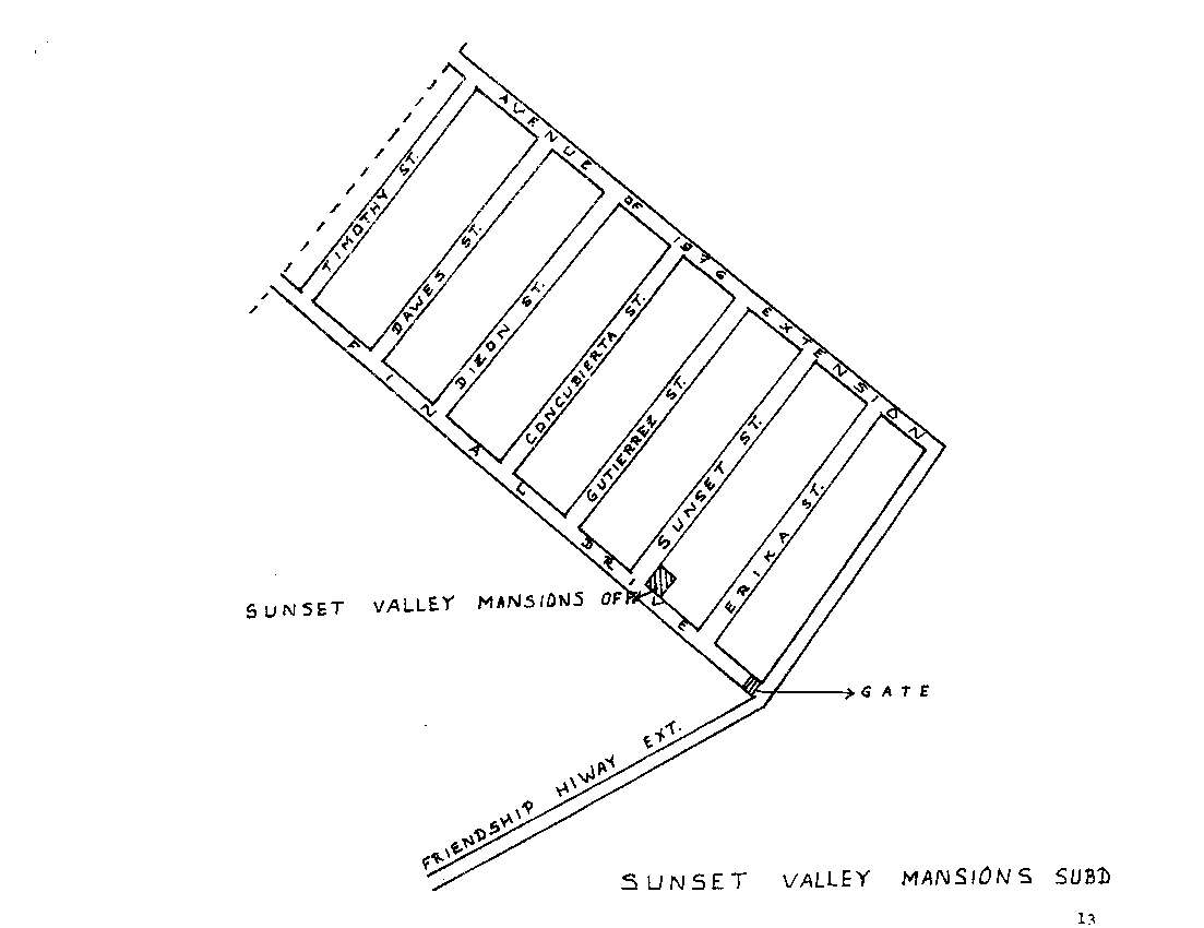
Sunset Valley subdivision, Angeles City. |
 |
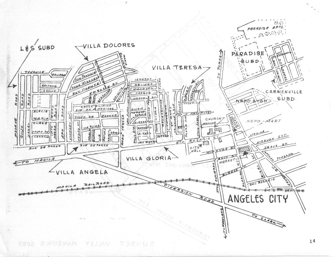
Villa Dolores, Villa Teresa, Villa Angela, Paradise, and Carmenville subdivision areas. |
 |
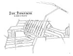
Balibago subdivision, Angeles City. |
 |
Plaridel subdivision, Angeles City. |
| Specific buildings |
 |
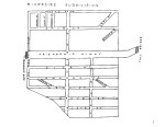
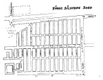
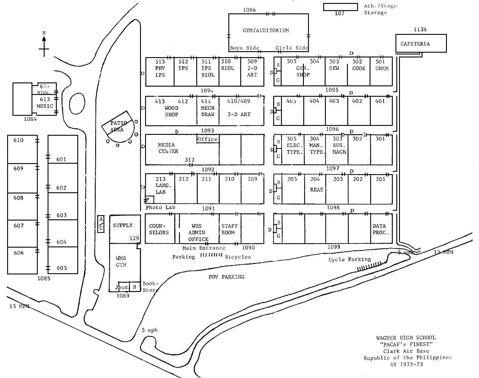
Wagner High School, 1973 classroom map |
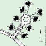 |
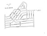
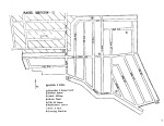
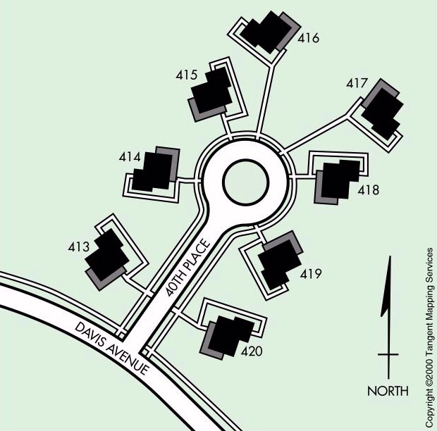
40th Place map showing an example of how a "circle" was laid out in the Hill Housing area. |
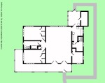 |
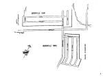
Hill Housing floor plan, Plan A. |
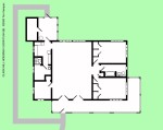 |
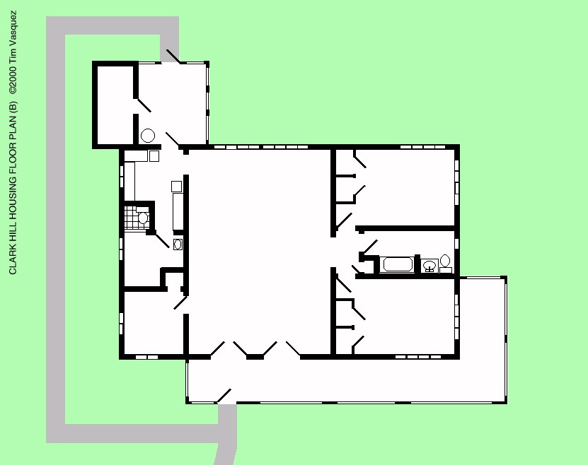
Hill Housing floor plan, Plan B. |
| Clark nowadays (CSEZ) |
 |
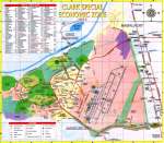
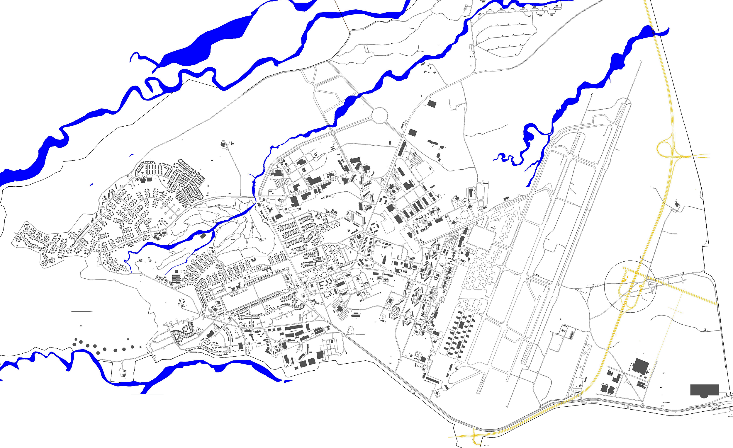
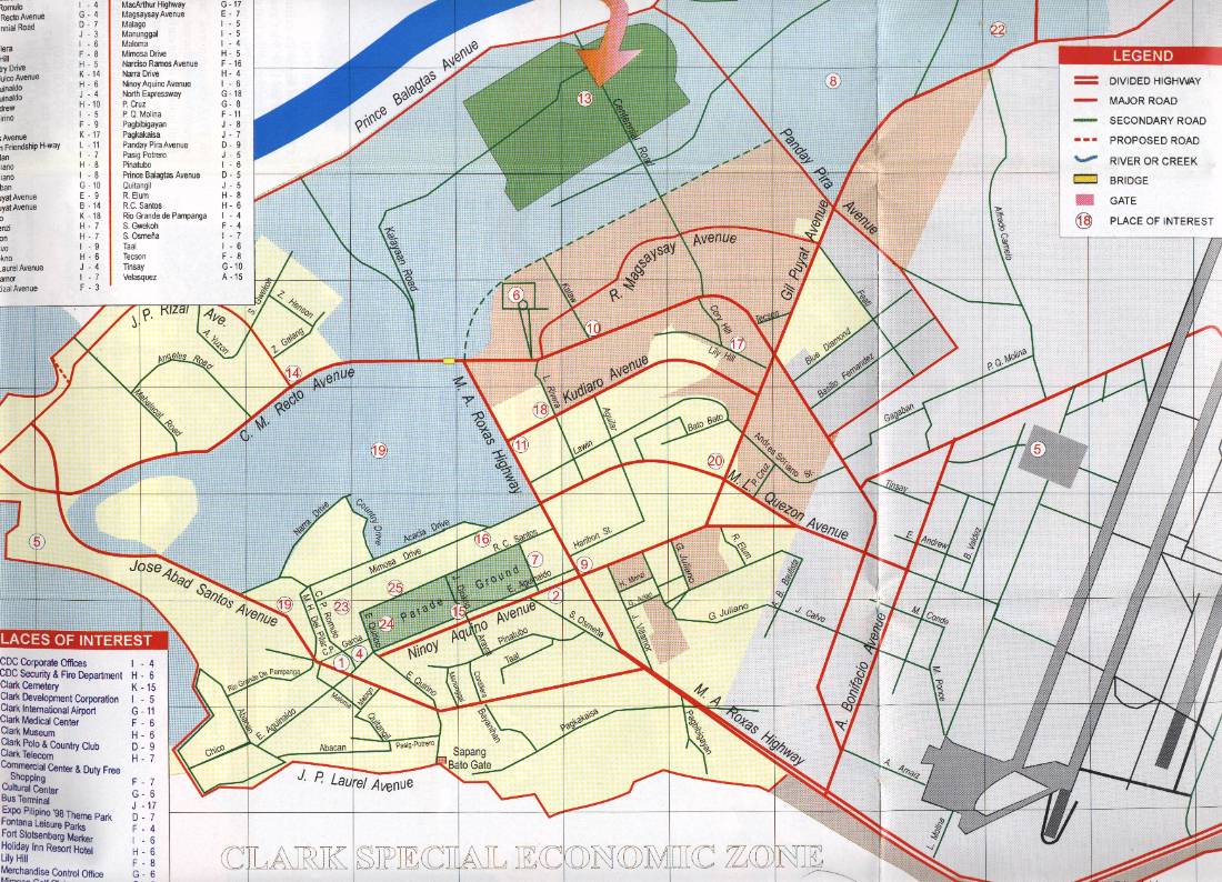
Detailed building and street map, 2008 for the Clark Freeport area. This is built from GIS data; no annotations. |
 |
Older Clark Special Economic Zone, 2001 simple map. |
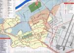 |
Older Clark Special Economic Zone, 2001 simple map. |
 |
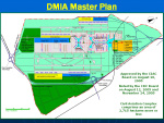
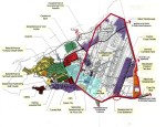
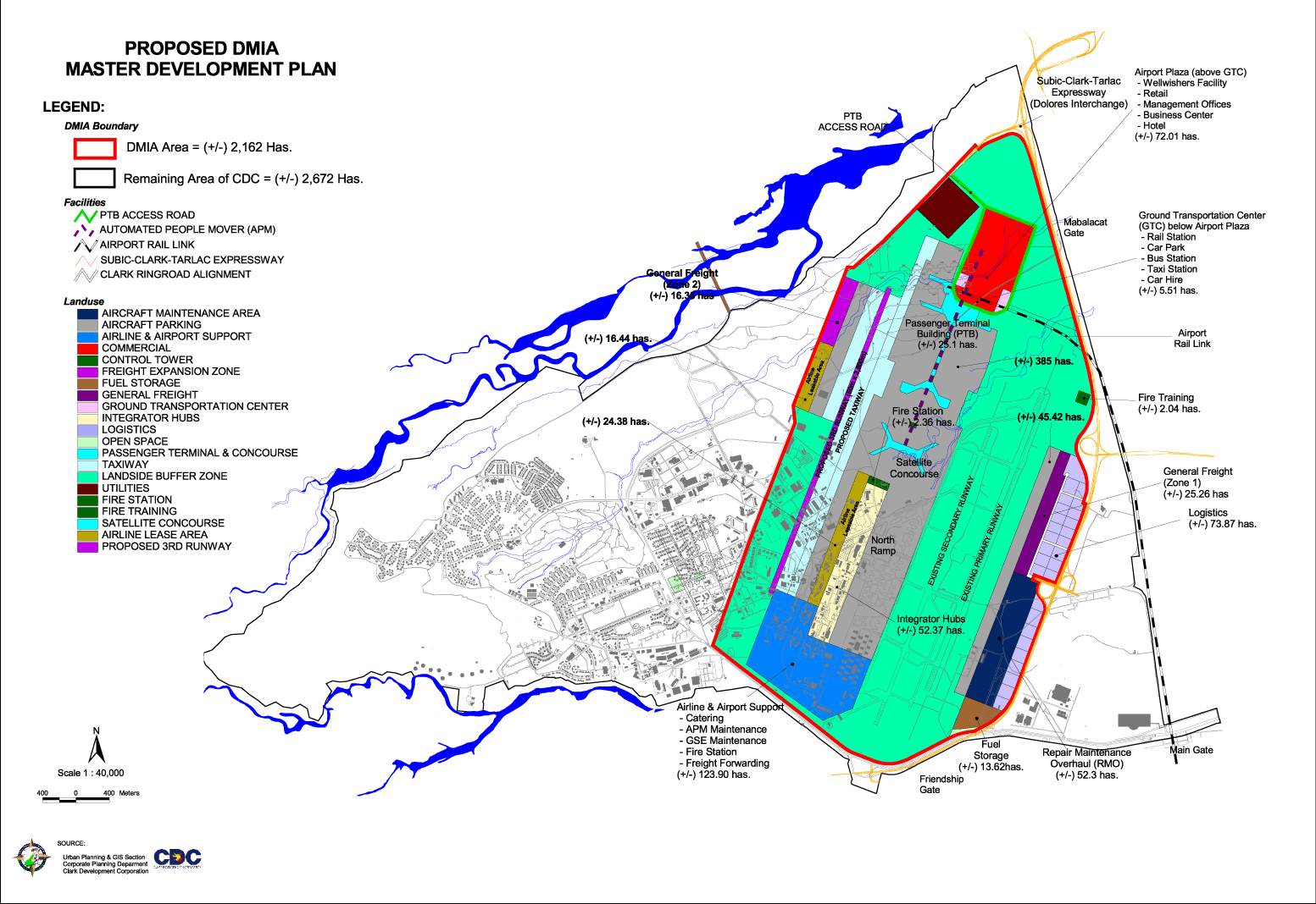
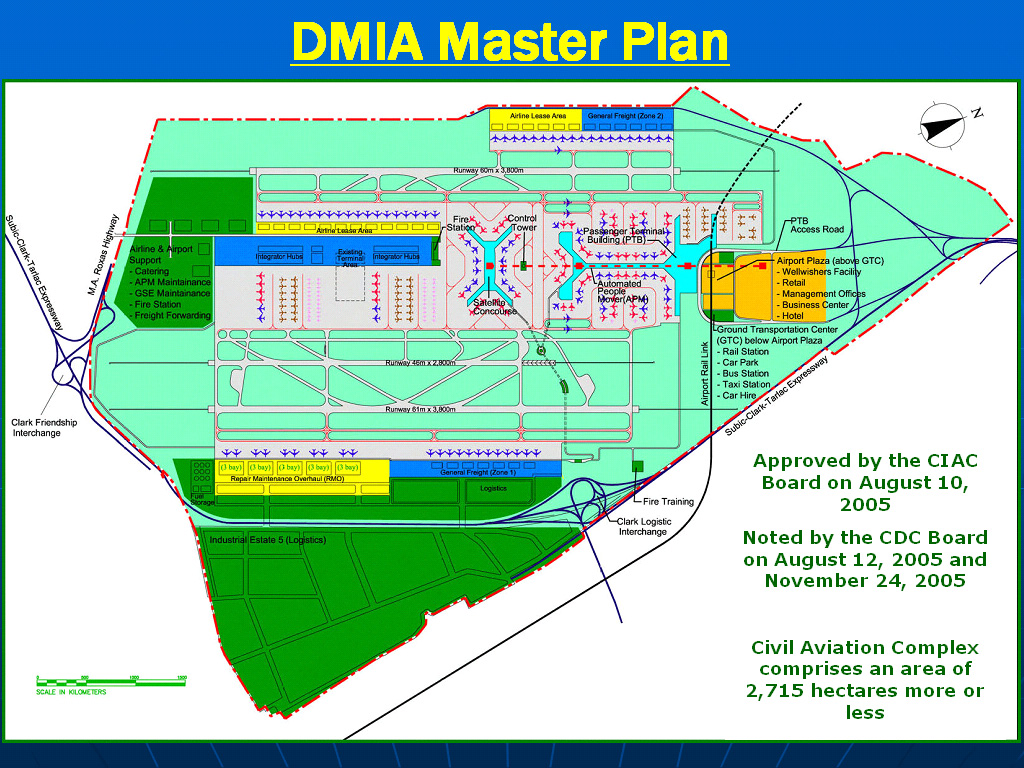
Clark International Airport Master Plan, 2008 (Diosdado Macapagal International Airport, or DMIA). |
 |
Clark International expansion plan, 2008, (Diosdado Macapagal International Airport, or DMIA)
showing a massive expansion proposed for the 2010s. If and when built, most of the dormitory area
and flightline area east of the Silver Wing and Airmens Club will be completely gone. |
 |
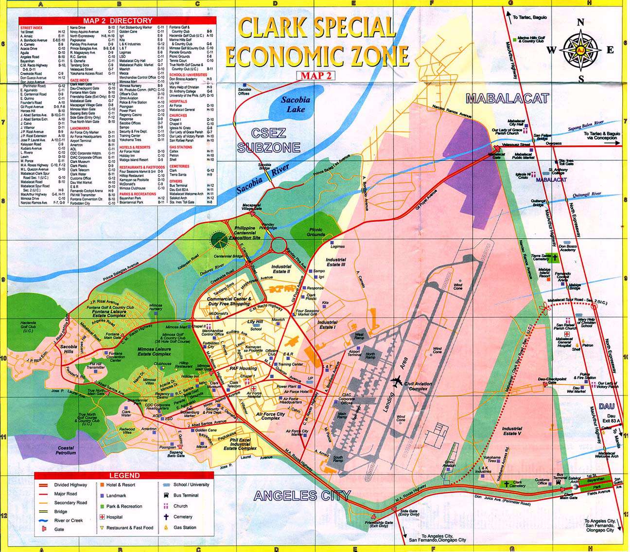
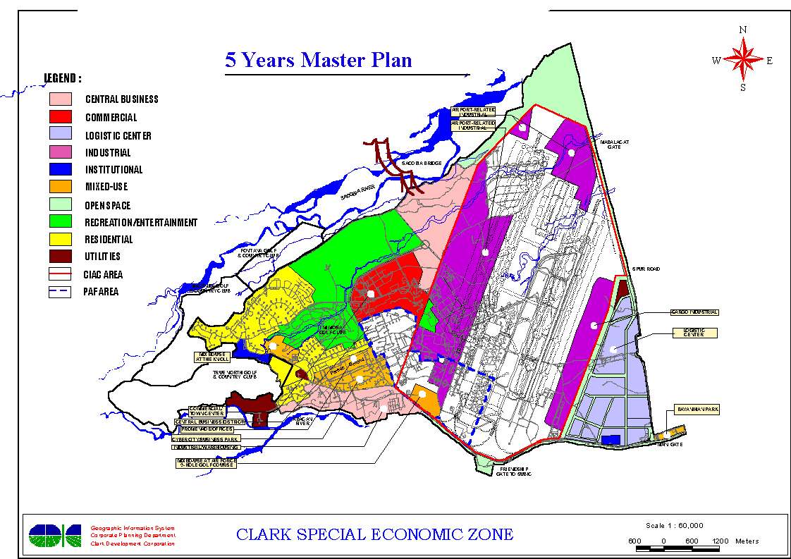
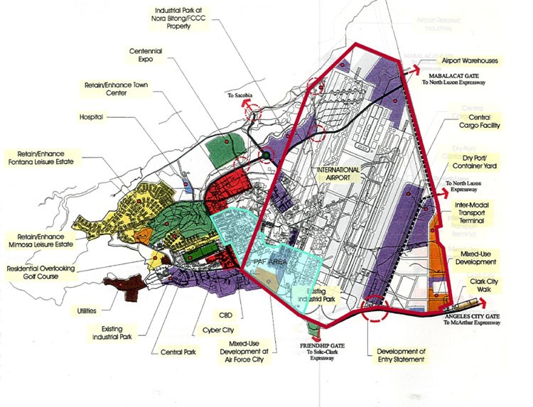
CSEZ master plan for 2001-2006 showing the large purple airport area which would later be
part of a DMIA expansion. |
 |
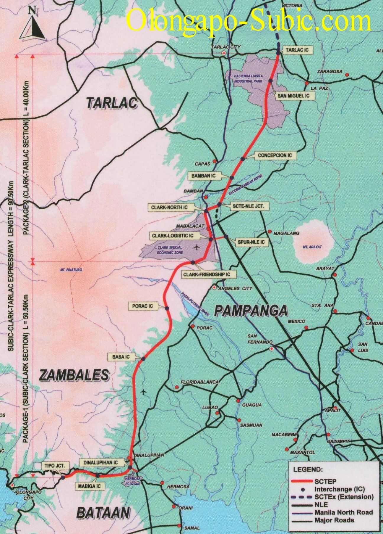
Subic-Tarlac Expressway, 2008, an expressway now in operation that crosses part of the former Clark Air Base. |
 |
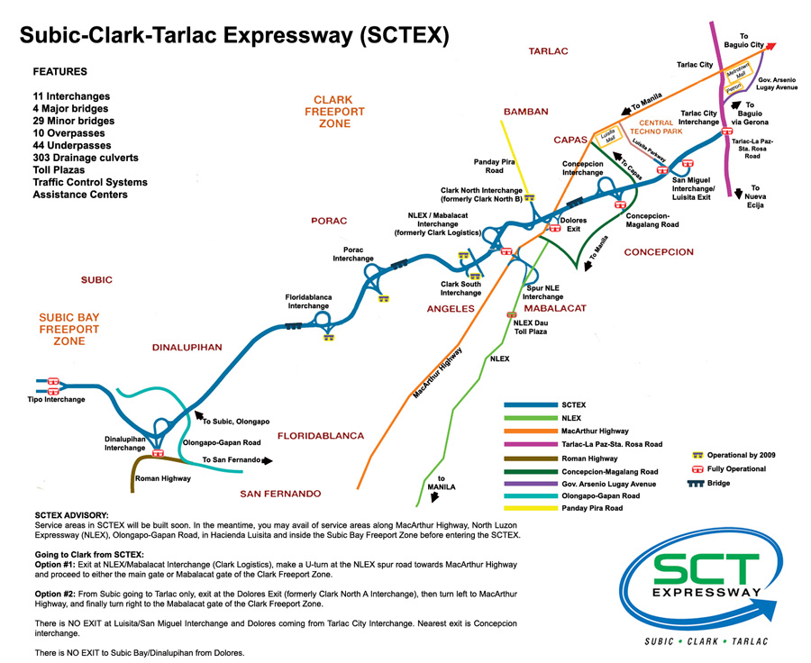
Subic-Tarlac Expressway, 2008, access diagram. |
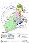 |
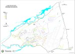
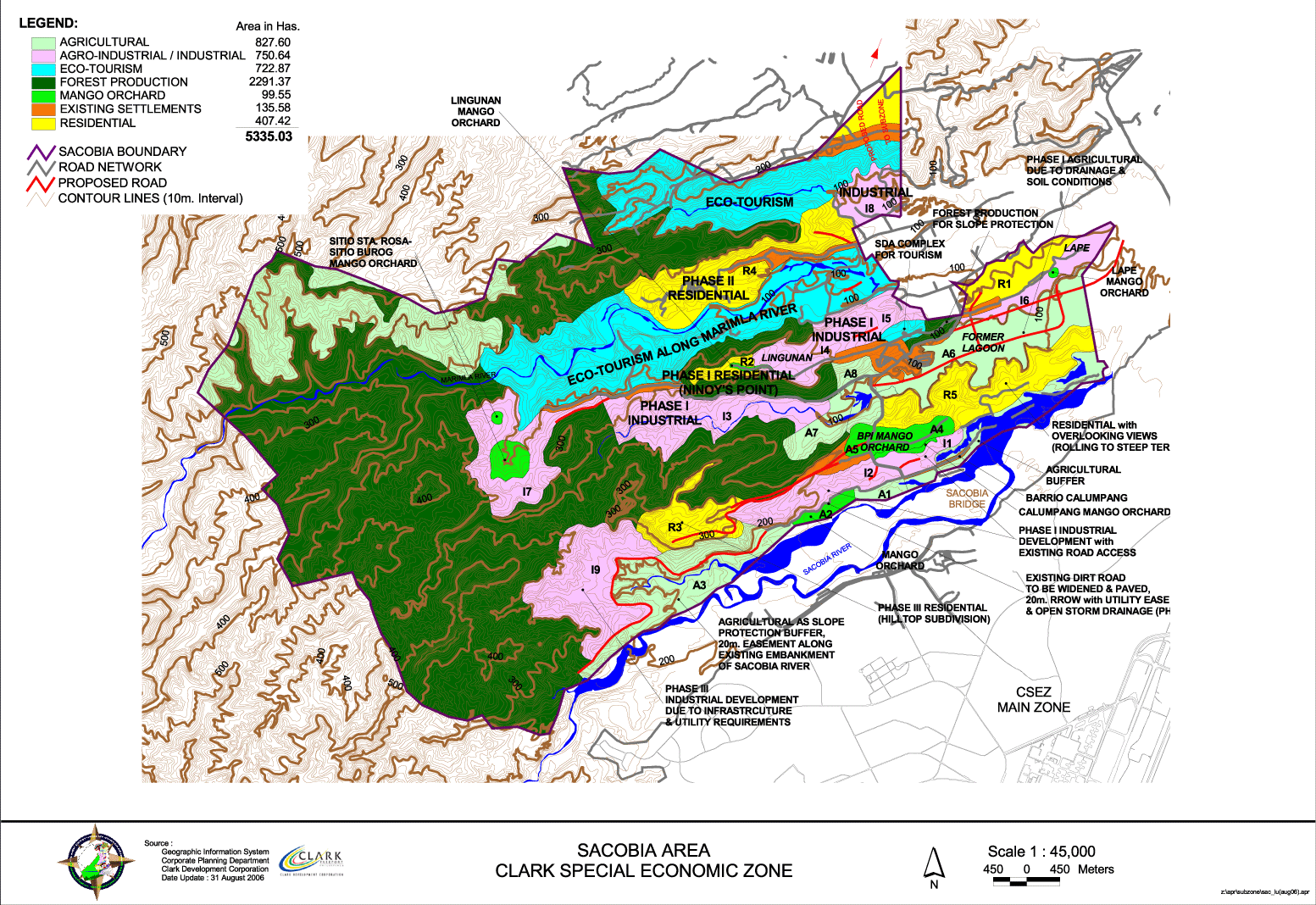
Clark CEZ land use plan, 2008 suggesting development in the hills north of the former base. |
 |
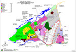
Clark CEZ land use plan, 2001, showing nearly half of the base given up to a proposed superairport. |
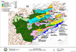 |
Clark CEZ land use map, 2008. |
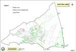 |
Clark CEZ electric schematic, 2008. |
 |
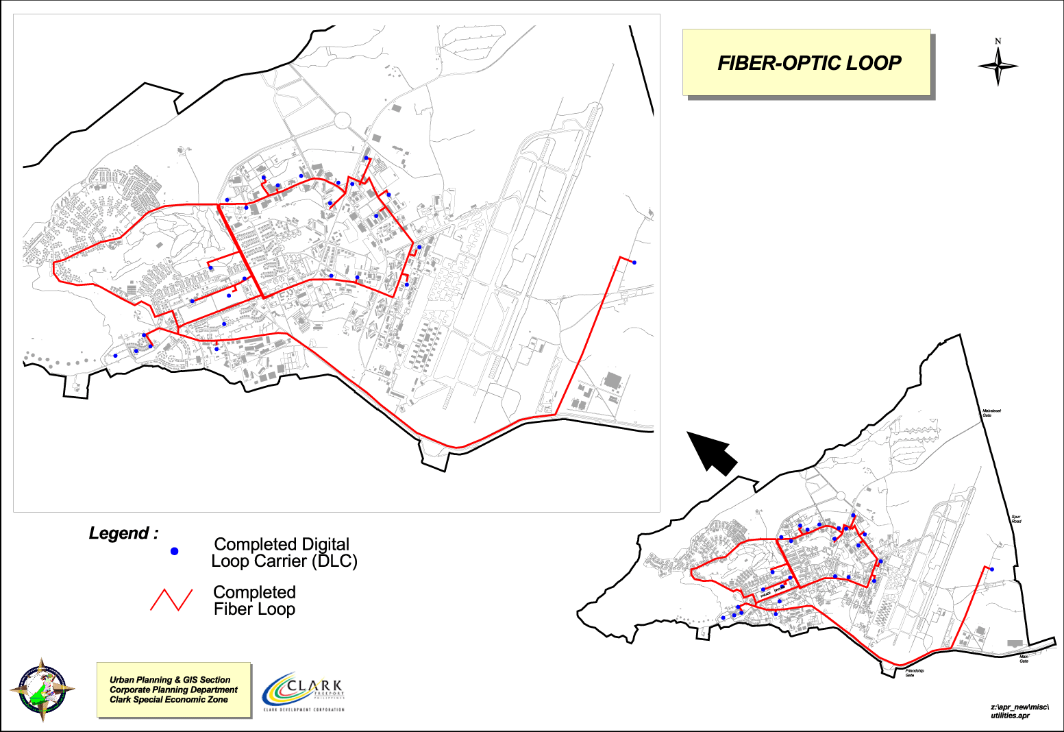
Clark CEZ fiber optic schematic, 2008. |
 |
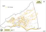
Clark CEZ short term plan, 2008. |
 |
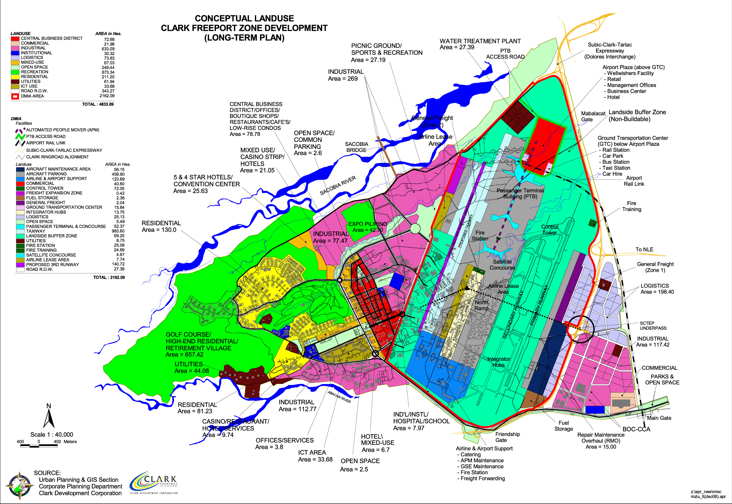
Clark CEZ long term plan, 2008. |
 |
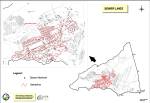
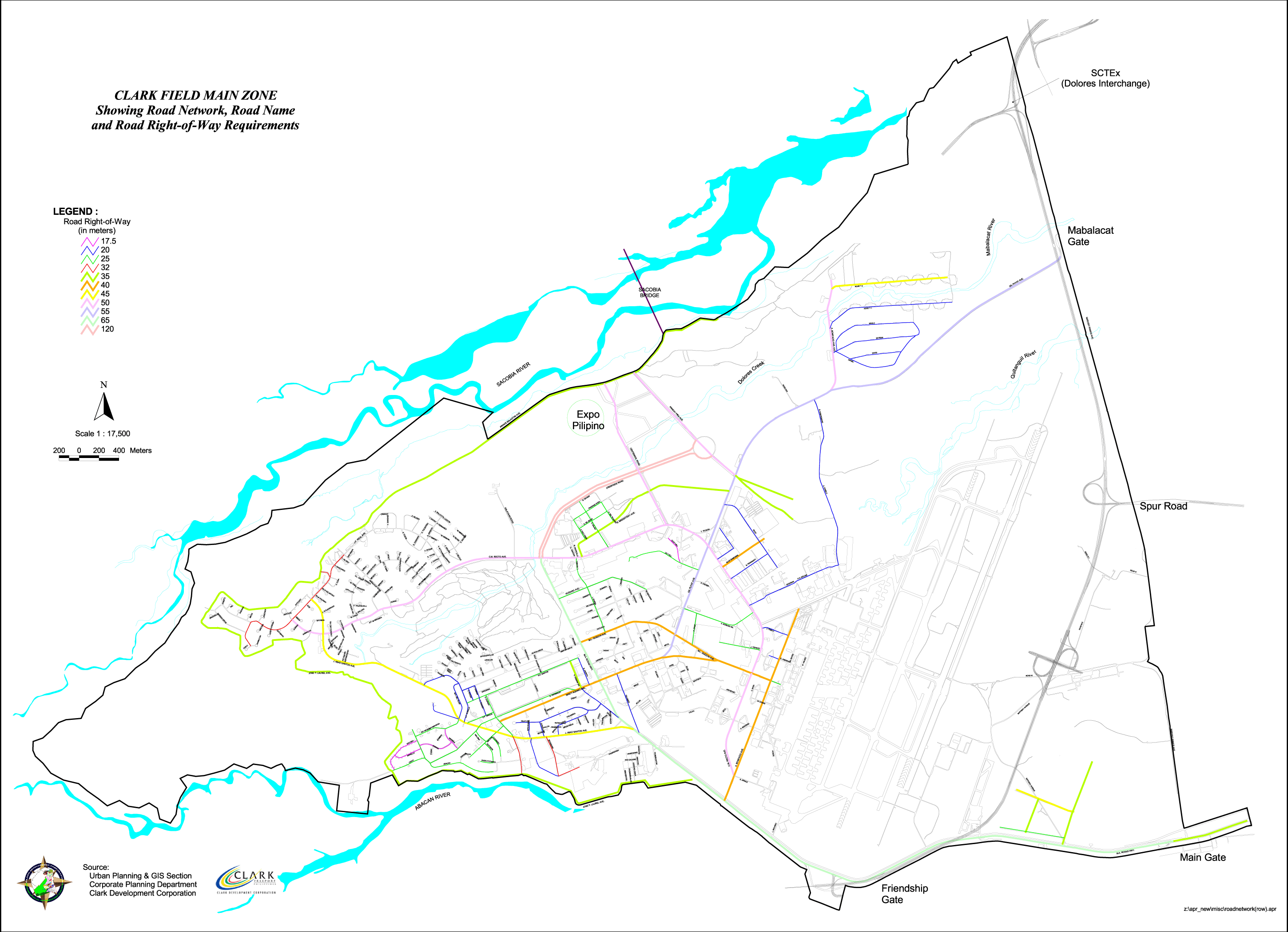
Clark CEZ road layout, 2008. |
 |
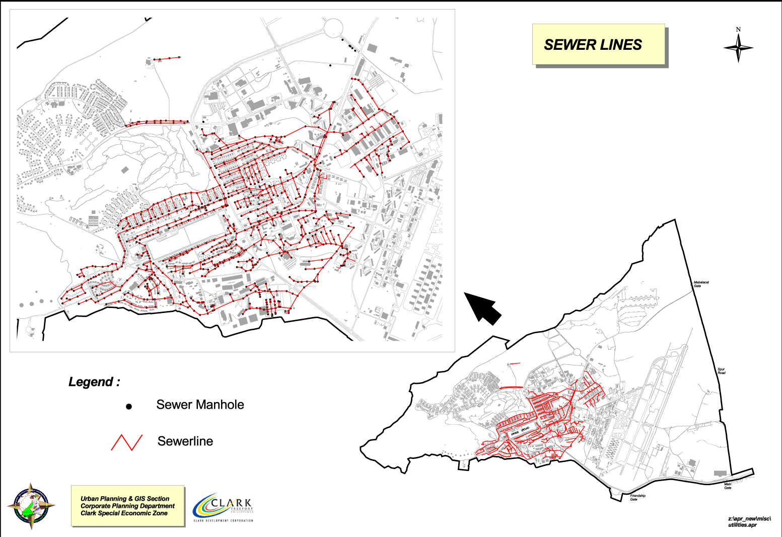
Clark CEZ sewage diagram, 2008. |
 |
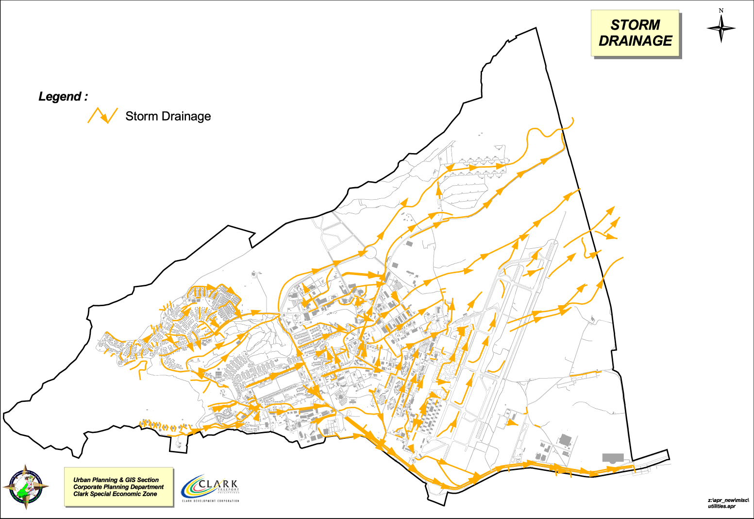
Clark CEZ storm runoff diagram, 2008. |
 |
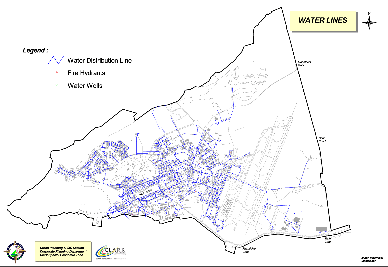
Clark CEZ water lines diagram, 2008. |


